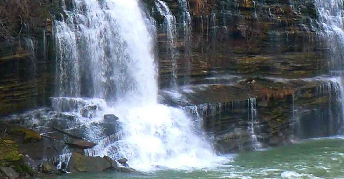
 The land of falling water, the western edge of the Cumberland Plateau. Four counties, seventy-two waterfalls. This area is home to the highest waterfall in the eastern United States; but vertical drop doesn’t necessarily determine spectacular. Sometimes the beauty of a falls may be the clarity of the water, sometimes it may be the surrounding landscape, sometimes the sound is so unique you can enjoy it with your eyes closed, in this case all of the last three criterion apply. Nestled on the edge of Fall Creek Falls State Park, the discovery of this falls was so recent; it doesn’t yet show up as a Tennessee landform.
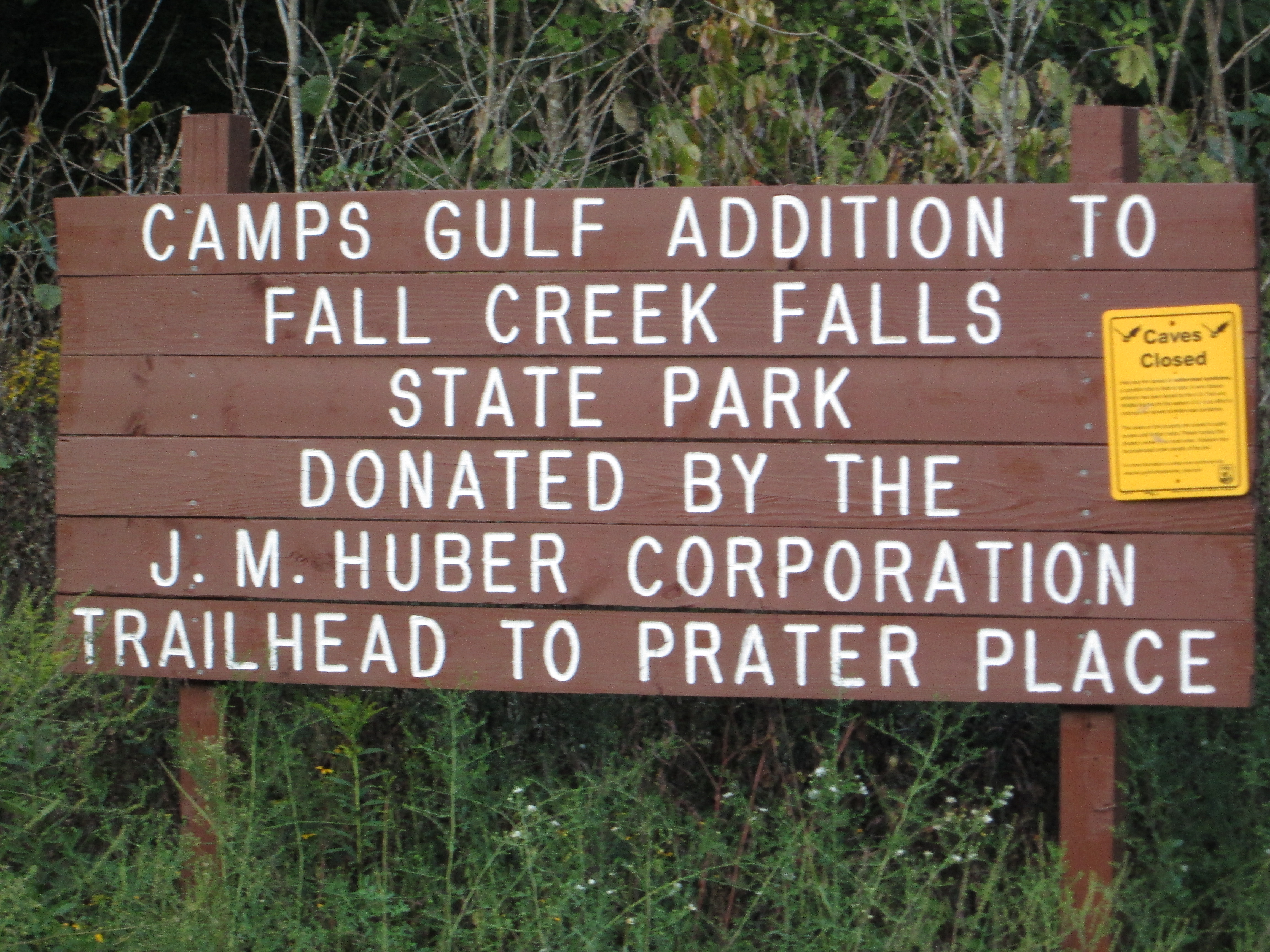
The falls marks the end of the Prater Place Trail. Though the sign at the trail head says it’s 2.7 miles; two GPS’ indicate it is 3.67 miles each way with a 500′ elevation change. The trail takes you near one of my favorite caves, Camps Gulf; and the Prater home place – – how did I settler eek out a living here?
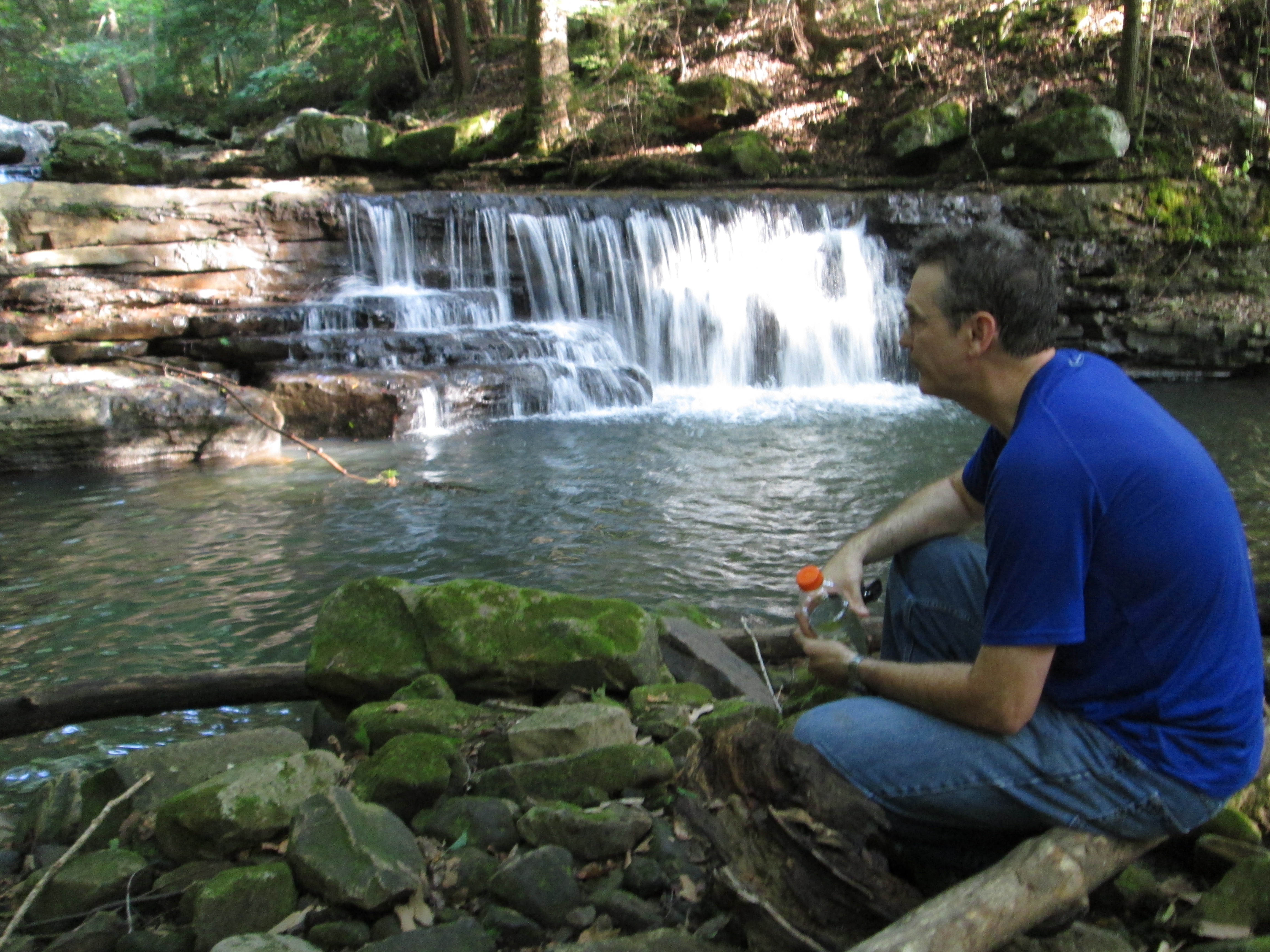
As you hike the trail, note that the stream bed may be dry. During rainy weather, it can swell substantially as water will dump out of the cave systems into this creek. But on a typical summer’s day, you may be discouraged – – don’t be. Somewhere, between Cane Creek and the falls the water disappears. Die tracing shows it winds up in Camps Gulf Cave only to flow out a few miles away at the Crusher Hole.
To get to the trail, from Hwy 111, head east on 285 6.4 miles. When you cross the Cane Creek bridge; the trail parking lot will be the second road on the left. It’s worth the drive and the hike.
 [mashshare]
I believe your GPS also. We hiked this trail in July on a rainy Sunday afternoon. It was a very difficult hke with slippery, steep trails and rocks after the rain. The falls was beautiful though. I want to go back later this year. Thanks for the post.
This is one of mine and my wife’s favorite trails. It’s secluded, somewhat overgrown and foot traffic is minimal. It’s likely you wont see another person on your hike, but if you pay attention you can find evidence of the animals in the area, such as boar and deer. If you follow the trail to the right at the “no camping” sign about a mile in you can cross the creek to the trail leading up to Camp’s Gulf Cave, which is worth the climb to the cave mouth. The cave is accessible to the public by permit only, contact park rangers at fall creek falls for more info on that. There are many limestone outcroppings and sinks on the way to the falls and the scenery is beautiful. Be aware that the trail is moderate to strenuous in some areas with steep inclines, slick loose rocks and lots of mud, so wear appropriate foot wear.