[mashshare]
[mashshare]
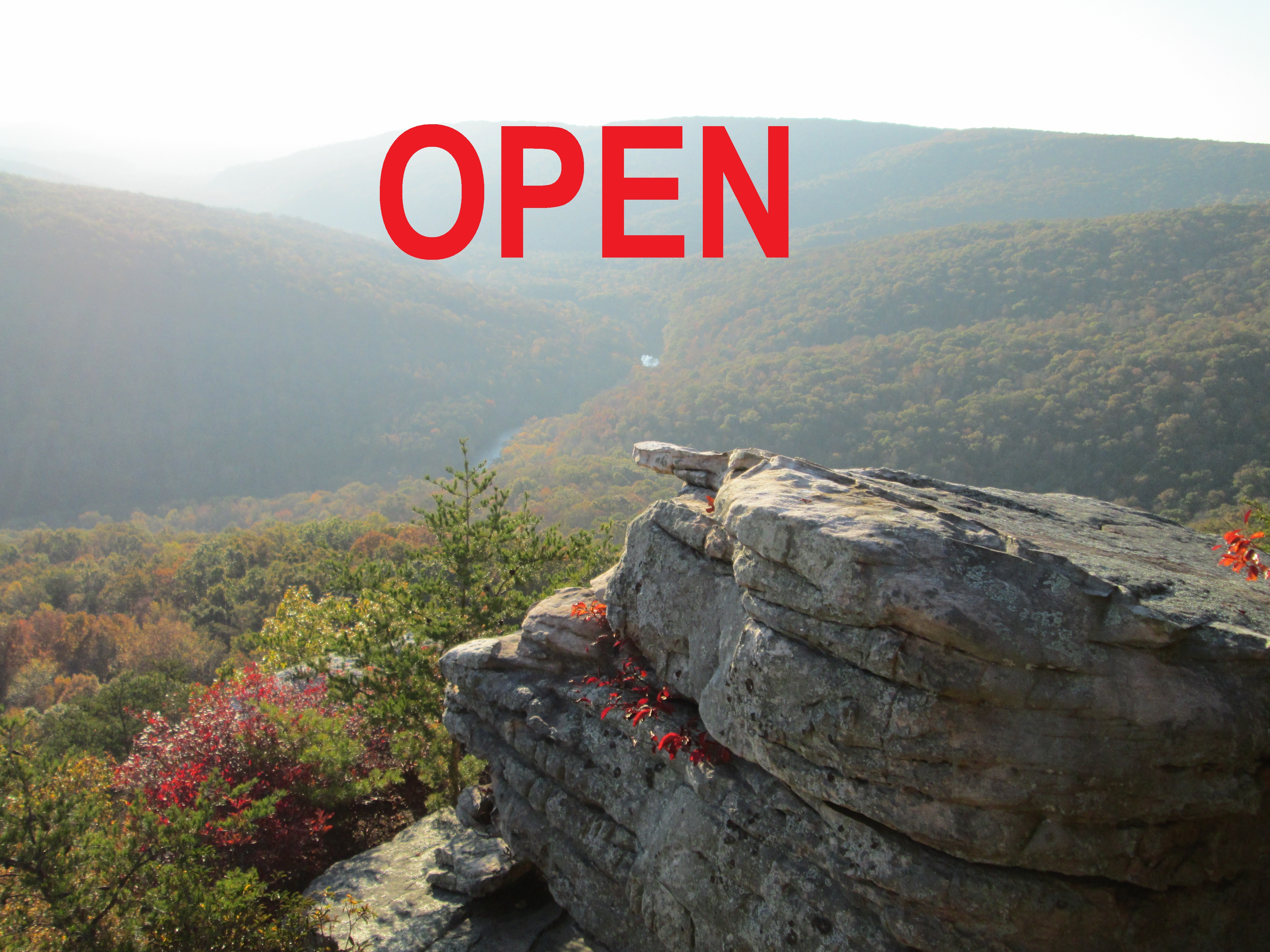
Tennessee Wildlife Resources Agency and the Tennessee Department of Conservation and Environment have reached an agreement allowing Welch’s Point to remain open all year long. This is one of the most spectacular overlooks in the state of Tennessee and will offer those who are unable to hike the Virgin Falls Trail a perspective of what the Mid-Cumberlands has to offer.
Please be aware that you are driving through a wildlife refuge as you drive to Welch’s point and the side trails past Virgin Falls are not open during hunting season. Virgin Falls Trail remains open all year long.
To get to Welch’s Point; about half-way between Sparta and Crossville, turn south off of US 70 onto Eastland Road (next to LBJ&C). The closest GPS address will be 5747 Eastland Rd, Sparta, TN 38583 (Gulf Trading Post).
From the Gulf Trading Post, turn south onto Scott’s Gulf Road. Follow the gravel road and fork to the right immediately past the parking lot for Virgin Falls Trail. About three miles past the fork, you will enter a large gravel parking area with the remains of an old cabin and the hint of a view into the Caney Fork River valley; then follow the foot trail (about 400′) to the overlook. The park closes at sundown. Welch’s Point may be closed for ice, snow or inclement weather.
[mashshare]
Representative, and senatorial candidate, Paul Bailey and White County’s newly elected County Executive, Denny Wayne Robinson met with members of Tennessee Trails and Tennessee Wildlife Resources Agency at Welch’s Point in September. Just over one month later, there is indication that Welch’s Point will soon be open to visitors in addition to hunters. This shows the 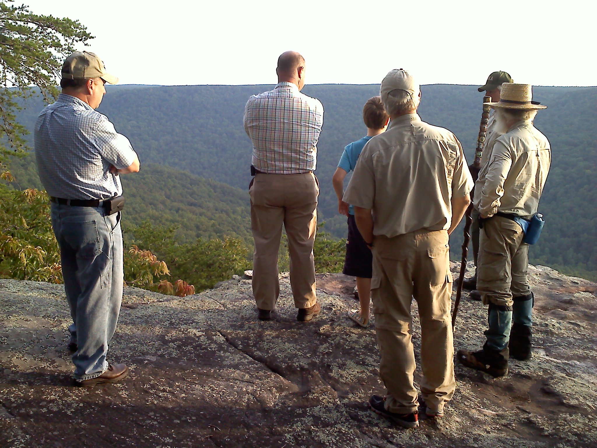 benefit of living in a democracy. White County, we need to be talking this up. Every citizen in this county and state has a stake in access to Welch’s Point and the remainder of Scott’s Gulf, now known as the Bridgestone Centennial Wilderness Area.
Welch’s Point was partially funded by the Tennessee Heritage Conservation Trust Fund which gains its dollars from a transfer tax. Whenever ALL Tennesseans sell their real estate, they are taxed on the transaction and therefore, the funds should only be spent on properties that are available to all Tennesseans.
The Bridgestone Centennial Wilderness Area was a gift to all Tennesseans from the Bridgestone tire company. The restrictions on the Bridgestone gift are riddled with statements indicating that the “uplands” portion was to be managed as a wildlife management area (hunting), and 1000′ from the rim line and down into the Caney Fork River Canyon were to be open for other activities including hiking, kayaking, caving, etc.
Currently, the entire area is closed off from September through December except for hunters. If managed, like Bridgestone indicated in their restrictions – – there is ample Room for Both.
As you encounter Paul Bailey and Denny Wayne Robinson, let them know that you appreciate their efforts. Take a moment to contact them and your other representatives to ask why the restrictions are not being enforced as written and filed in the White County Courthouse. The deeds to both properties are available on CragrockUSA.com for your perusal.
It is long past-time that these properties are available for all Tennesseans to enjoy. Please share this link with friends and any pertinent facebook groups and lets get these Tennessee treasures open to all – – all year long.
[mashshare]
Milksick Mountain, , Island in the sky
Milksick Mountain, near Sparta TN, allegedly got it’s name when early settlers noted that those who consumed the milk from cattle grazing on this mountain often became ill; some died. Abraham Lincoln’s mother died of the same malady. At that point in White County history, land was open to grazing and people fenced their yards to keep livestock out. Enough people were harmed by the cattle that eventually the mountain was fenced off to keep the cattle from consuming the whitesnake root which grows along the slopes and results in tainted milk.
I once visited a pit in the side of Milksick Mountain and noted that many of the surrounding trees were damaged by lightening. Some of the scars on the trees had grown over, some were quite fresh indicating that lightening truly does strike the same place more than once. In the case of this pit, Elwin Hannah, a geologist friend explained that the ionized air emanating from the pit probably attracts lightening.
On a final note, and how suiting as we approach Halloween, I have often heard that Milksick Mountain is haunted by a witch. Many have reported hearing “blood curdling” screams along the mountainside at dusk. Some discount the shireking as a mountain lion – – or could it be someone who lost their life from drinking the tainted milk a long, long time ago?
I would love to hear any stories that you have to share regarding Milksick Mountain.
[mashshare]
Leesia Champion added: Near Doyle, there was supposed to be a headless horseman that haunts the road I live on Halloween night. One Halloween night I dressed up and rode my horse to scare the kids on a hay ride. My horse spooked so badly in that area I had to put her up.
Also the property that I live on used to be the old Iva Mason property. She came up missing and has never been found, but they say she was in my well. The last time she was seen was selling cattle and then nothing afterwards. Sometimes at night you can hear piano music – – she had played the piano.
Robert Sparkman added: Spent many a night up at the fire tower. We thought it was a Sasquatch. Heard some real weird stuff up there.
Steve Ware My Boy Scout troop 174 hiked cross-country from my house on Windsor Drive to the Fire Tower and back. We did it all by map and compass. Of course Dad, the scoutmaster, kept tabs on our navigation. It was a wonderful hike and lots of fun. Yert!
Karen Hyder LaFever My greatgrandfather’s farm is just south of Milksick. We live there now. My grandfather told many stories of the wild sound heard. He said he had heard many bobcats scream but none were like this. He told of a coon hunt on the mountain on night. The dogs were turned loose to search for coons. the hunters built a fire and sat around waiting for the howling to begin. All of a sudden he said everything got deathly quiet. Then out of no where a very cold breeze came through their camp and the fire went out. Their dogs appeared all of a sudden with no howling, only shivers. They heard this horrible scream and they all left the mountain quickly.
Tommy Frasier I lived at the base of Milksick in the late 80s. I heard some odd sounds.
Pam Hall My grandparents Frank and Elizabeth Goolsby lived on Milksick when their youngest son Donnie was born. He got sick from the cows milk. Grandma gathered fresh greens in the spring for a salad and they all got sick from them. Grandpa was giving her the dickens because he said she should know what was good to eat since her mother was a herb woman. They moved back to Sparta after that.
Carless Winnett our scout troop camped up there and we stayed awake all night waiting but nothing happened but we were ready to leave,used to take my girl friends there to,lol
Debbie Terry Ward This is the story of Milksick Mt as it has been told to me all of my life. The main thoroughfare from Sparta to Spencer was the Hickory Valley Road. A small circus came through the area and one of the “cats” got loose. The theory was it was a panther because of the scream. I grew up in Hickory Valley at the eastern side of the mountain. I do know the cattle or animals would not go near the mountain and the “scream” could be heard at night.
Kenneth Brogden has told about my grandfather, Joe Terry, going toward the mountain with the coon dogs and found him running back to the house as fast as he could go and the dogs were ahead of him. Kenneth did see an animal but it went back to the mountain as Pa got closer to home. This has been the general consensus of the event from the men of this era of what happened.
[mashshare]
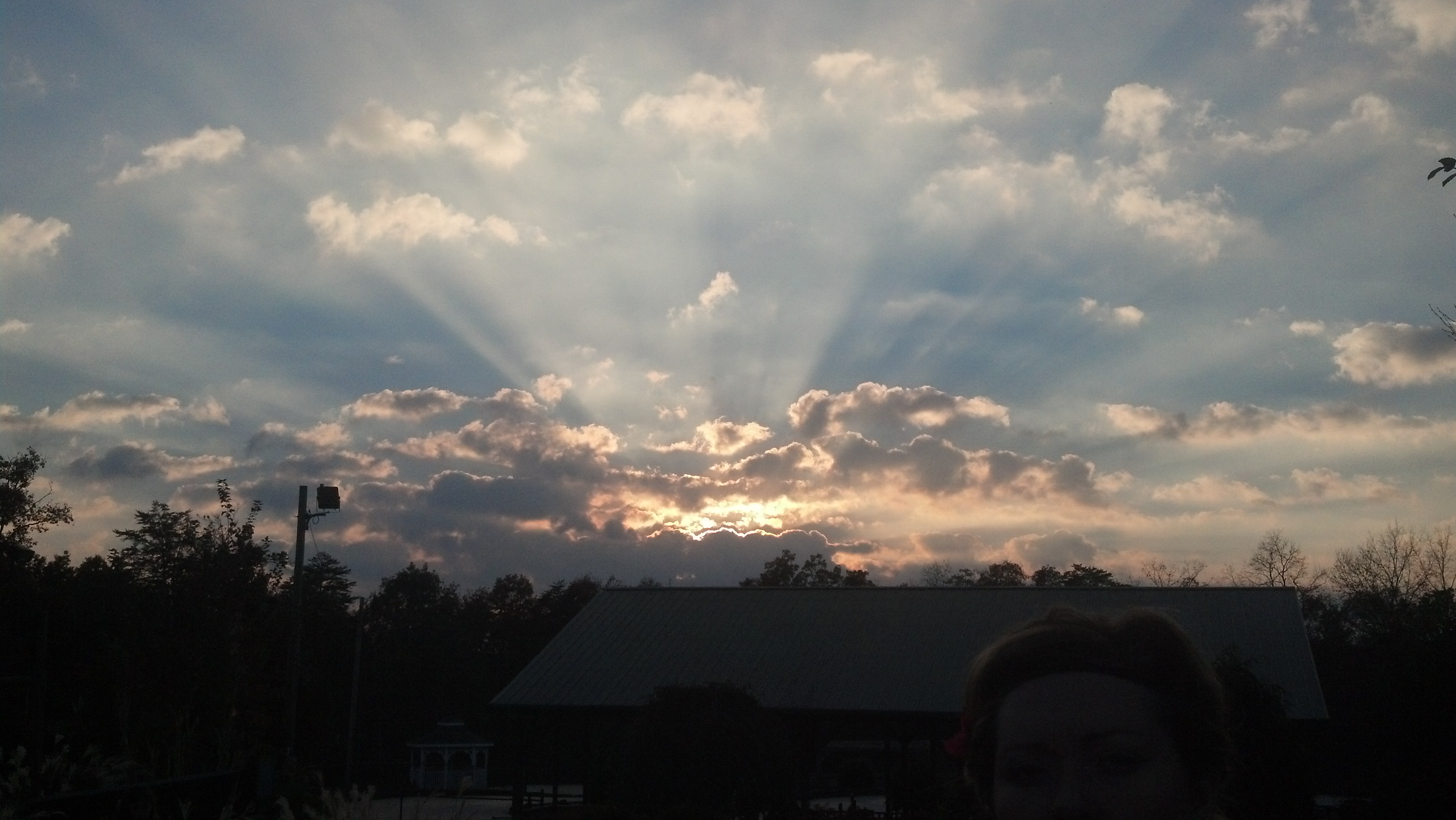
Photo courtesy of Travis Seibers
[mashshare]
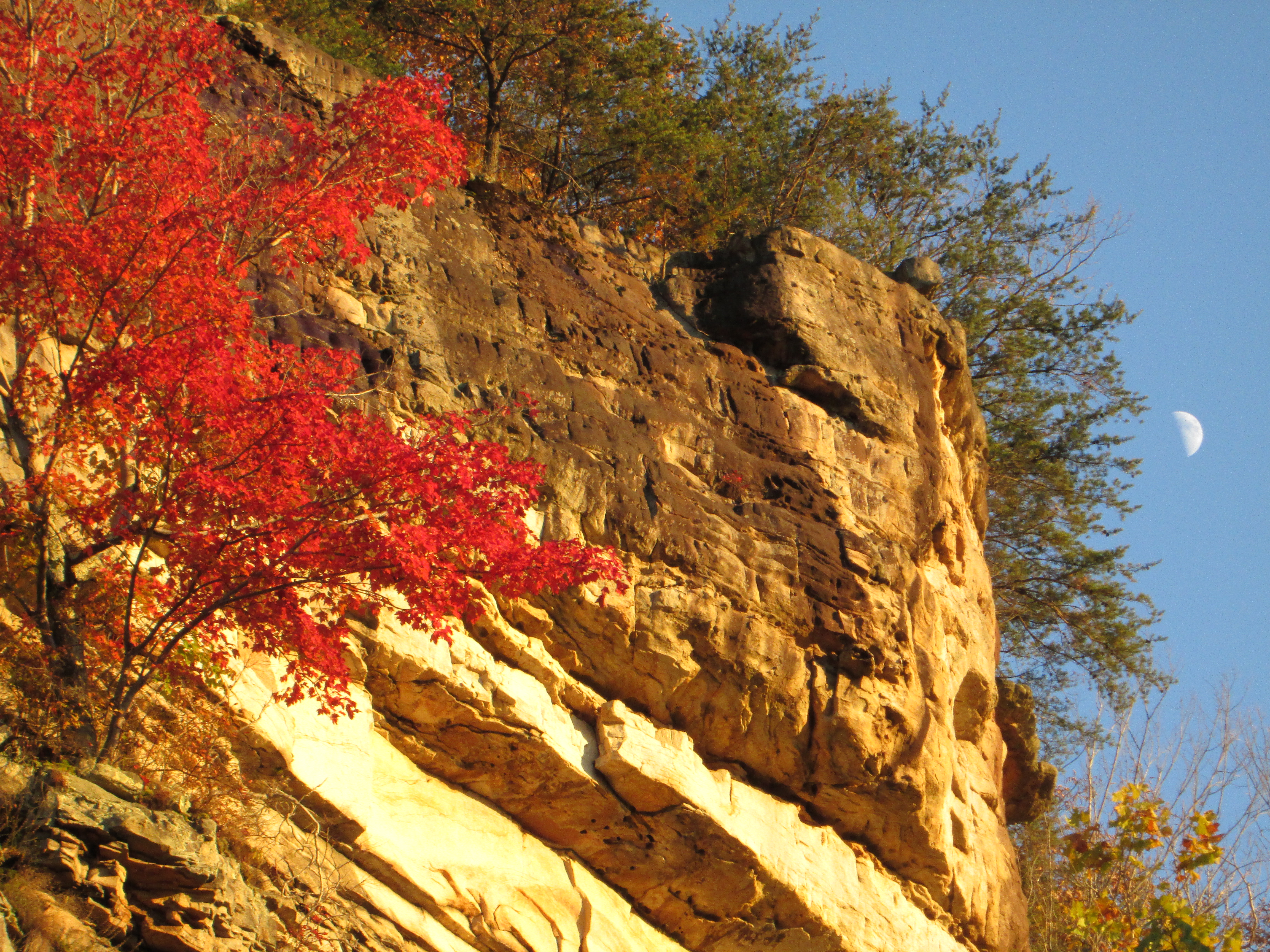
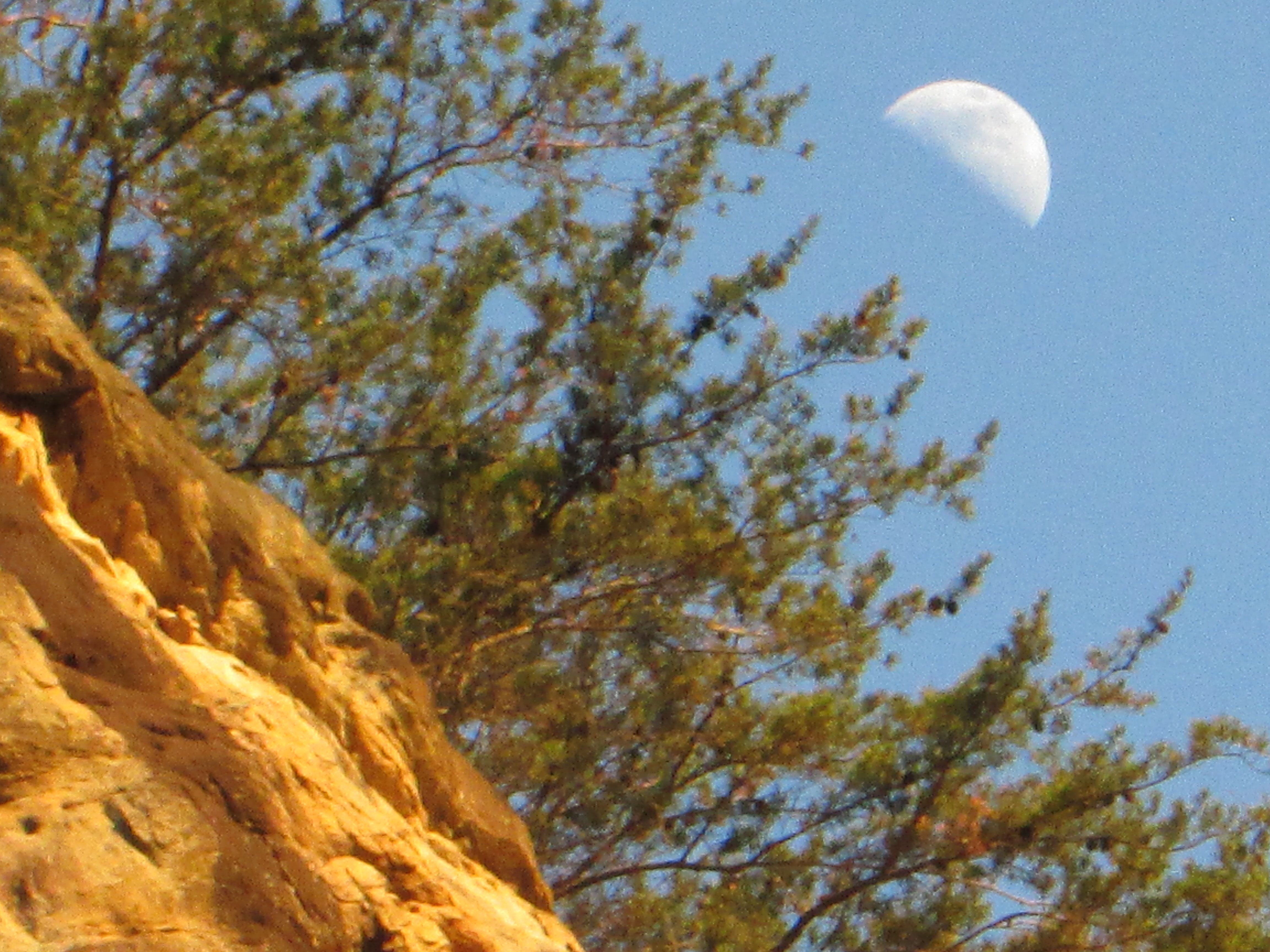
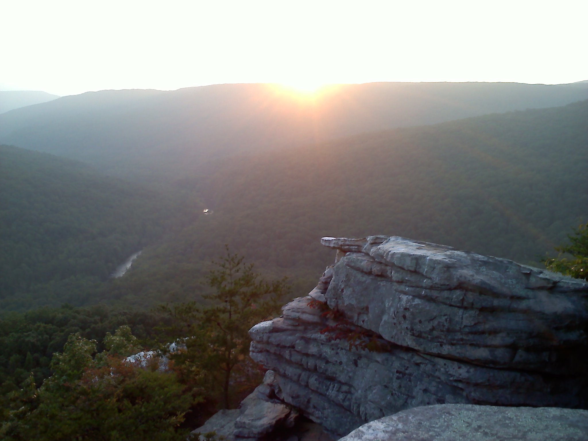
Sunset Rock, near Sparta TN. (taken near summer solstice)
What a suitable moniker, Sunset Rock. From solstice to solstice you can follow the sun across the western horizon. In the summer, the sun almost disappears behind the trees to the north, in the winter; it almost makes it to Spencer Mountain. As the earth tilts, from this longitude it appears that the sun travels about sixty degrees from June 21st to December 21st. Every sunset is different, some with clouds; some crystal clear. My favorite sunsets are the ones where there is a gap on the horizon between the earth and the clouds and the last few moments of twilight are broken by blazing orange tufts across the sky. Like a campfire, there is something primal about a sunset.
In high school, I used to come to Sunset Rock to practice climbing and rappelling. The west-most point, where the parking lot meets the highway is not much more difficult than a ladder to climb. I once brought a friend to teach her to rappel and rather than rigging along the vertical face, I thought I would start her on that corner to build up her trust in the ropes. To this day, I do not know what happened to the rope, but as she descended, the rope swung her clockwise around to the side where she suddenly found herself dangling about 30′ off of the ground and too far away from the wall to plant her feet. Her screams became hysterical laughter as she realized that the rope had held; the only injury – – she lost a contact lens.
In college I had a 1000 cc BMW Cafe Racer. I would often play the game of trying to time my ride from Cookeville to arrive at Sunset Rock just at sundown. To make it more interesting, I would travel different routes. US 70 to Mill Creek Road, down into Calfkiller and Hwy 84 one day; another day I would take Cherry Creek Road, and on some days I would test my luck on roads that I had never traveled before. When I sensed that I might not arrive in time to see the sun go down, my risk-tolerance would increase and I have drug a few grooves in the pavement with my footpegs on more than one day. I remember once in particular topping a hill to see the largest herd of deer that I have ever seen crossing the road in front of me; that was the only time I had ever seen those dual disc brakes literally emit smoke. Whew!

Sunset Rock before highway 70, courtesy of Charlie Floyd
The protrusion we call Sunset Rock was formed when Hwy 70 was built. You can still see the vertical boring marks along the western face over the parking lot. The cliff apparently became separated from the mountain when they straightened Crossville Hwy and cut another vertical face on the east side of the rock leaving the closest proximity that White County has to a butte.
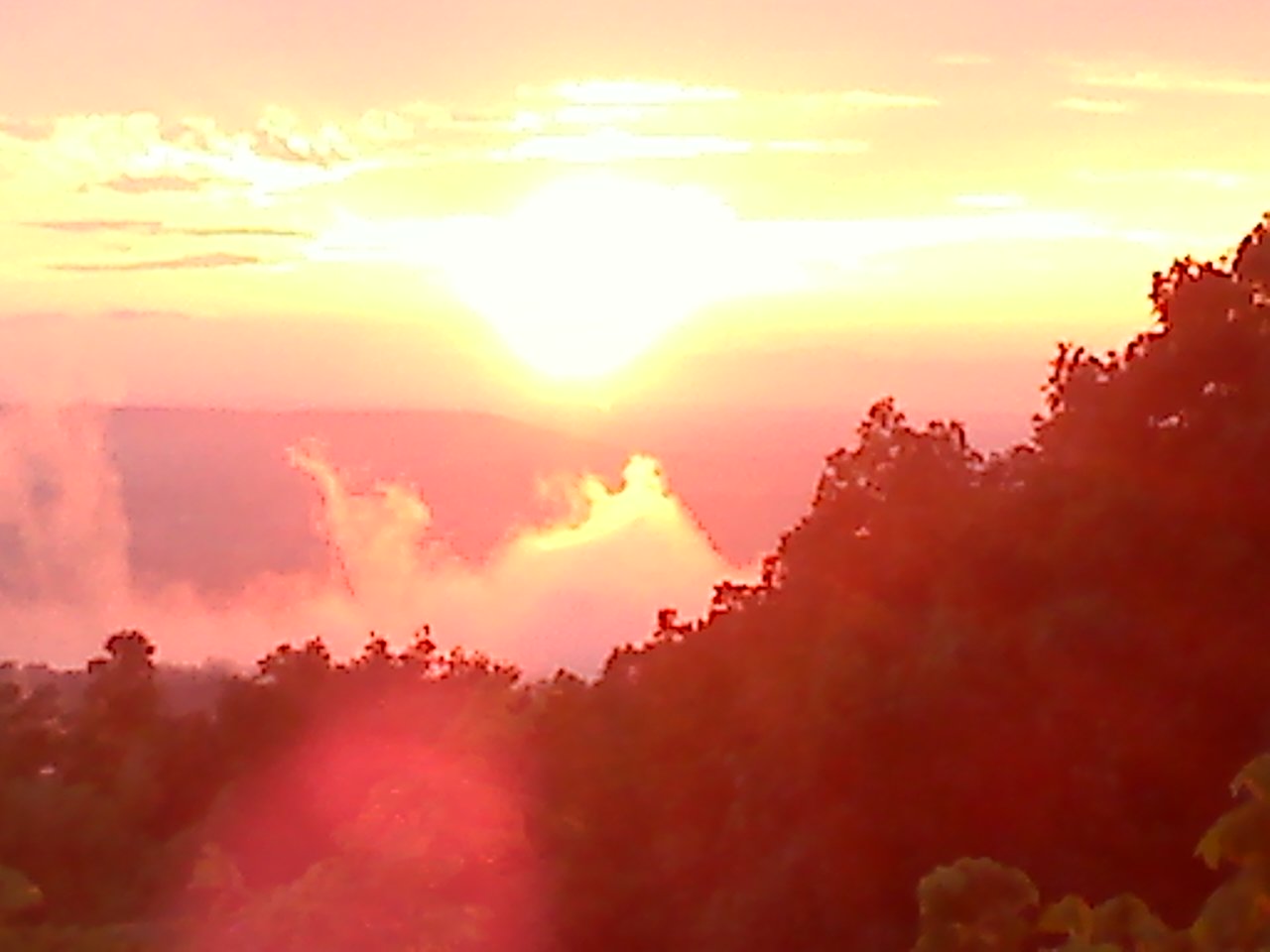
I no longer climb the rock faces of Sunset Rock, but I do occasionally climb the same rock post in front of Sunset Rock to take my sunset pictures. This gives me a stationary point to monitor our solar system’s star as it swings from summer to winter. The two photographs below were taken only nineteen days apart from atop of that same stone fence post. With Baker and Short Mountains in the distance, you can see what a difference less than a month makes in the sun’s progress.

October 22, 2014
October 03, 2014
If you have a favorite Sunset Rock photo or story, please use the posting feature to place your text and email me the pictures and I will add it to this blog, giving you full credit of course. Note that this is a moderated website so that your posts won’t appear until I’ve been able to log in and approve them. After they are posted, you can return to CragrockUSA and link them back to Facebook for every one to see. If this is working as intended, after you have had one post accepted, you will be able to automatically post in the future.
[mashshare]
Robert Sparkman added: Love your article. We used to practice rappeling on Sunset Rock because the face was flat and good to learn on. Spent many a day watching the sunset there. I remember it before they cut the road behind it. We have not lived in White County for twenty years now, but love remembering such a great landmark.
Charlie Floyd Sunset Rock did not used to be a rock. Rather it was a bluff around which the road ran (parking lot side). The “rock” was separated from the rest of the mountain when Hwy 70 was straightened in the early 60’s (I believe). SOmewhere I have a photo of my Father hanging on a rope off the original bluff. I believe I found it. (posted – – and priceless, thank your Charlie).
 TWRA welcomes visitors to one of the most spectacular overlooks in Tennessee. The gate is open this weekend. For many it will be the first opportunity to visit Welch’s Point. For over a decade the gate has been locked and access limited by a three-mile hike. Today, you can park within 400 feet of the overlook and walk down to Welch’s Point.
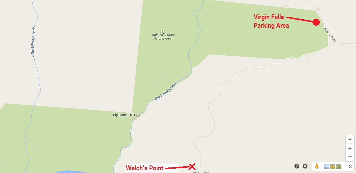
Driving directions to Welch’s Point.
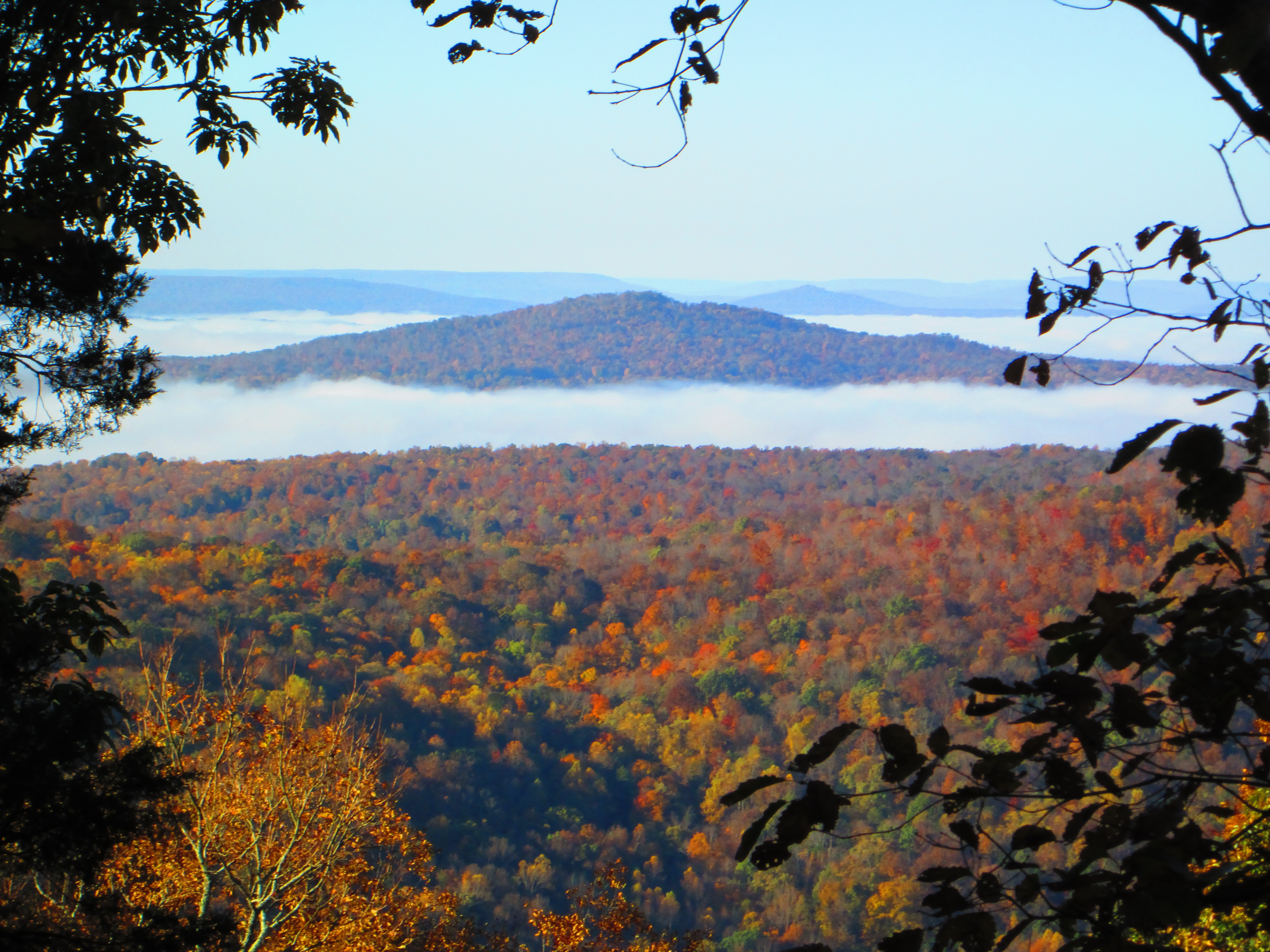
The fall leaves make this a special invitation. To get to Welch’s Point; about half-way between Sparta TN and Crossville, turn south off of US 70 onto Eastland Road. The closest GPS address will be 5747 Eastland Rd, Sparta, TN 38583 (Gulf Trading Post).
From the Gulf Trading Post, turn south onto Scott’s Gulf Road. Follow the gravel road and fork to the right immediately past the parking lot for Virgin Falls Wilderness Area. About four miles past the Virgin Falls parking lot you will get to a large gravel parking area with the remains of an old cabin and the hint of a view into the Caney Fork River Valley; then follow the foot trail (about 400′) to the overlook. You will be peering into Scott’s Gulf, the headwaters of the Caney Fork River. Across the gorge is
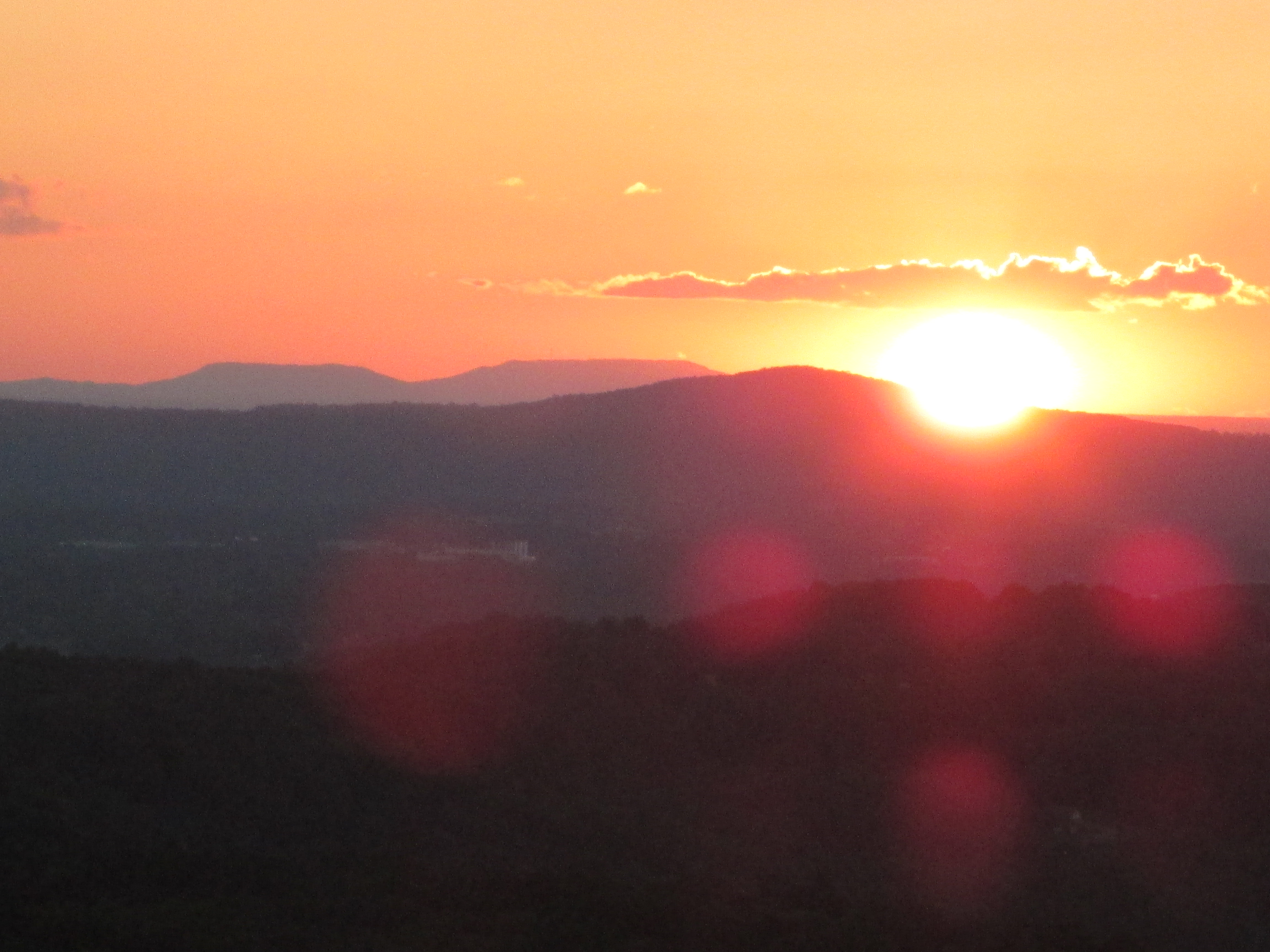
Sunset at Welch’s Point
Van Buren County, look west and you can see the break in the mountains called “Big Bottom”, where the river exits the Cumberland Plateau into the Tennessee Valley. The kayaking in the upper Caney Fork is so good, I have met paddlers from both Europe and Asia carrying their kayaks out of that canyon; they came just to run that stretch of river. The river is also brimming with fish from small trout to four-foot musky. It’s a site to see; see it today.

Virgin Falls Dedication at Welch’s Point.
[mashshare]
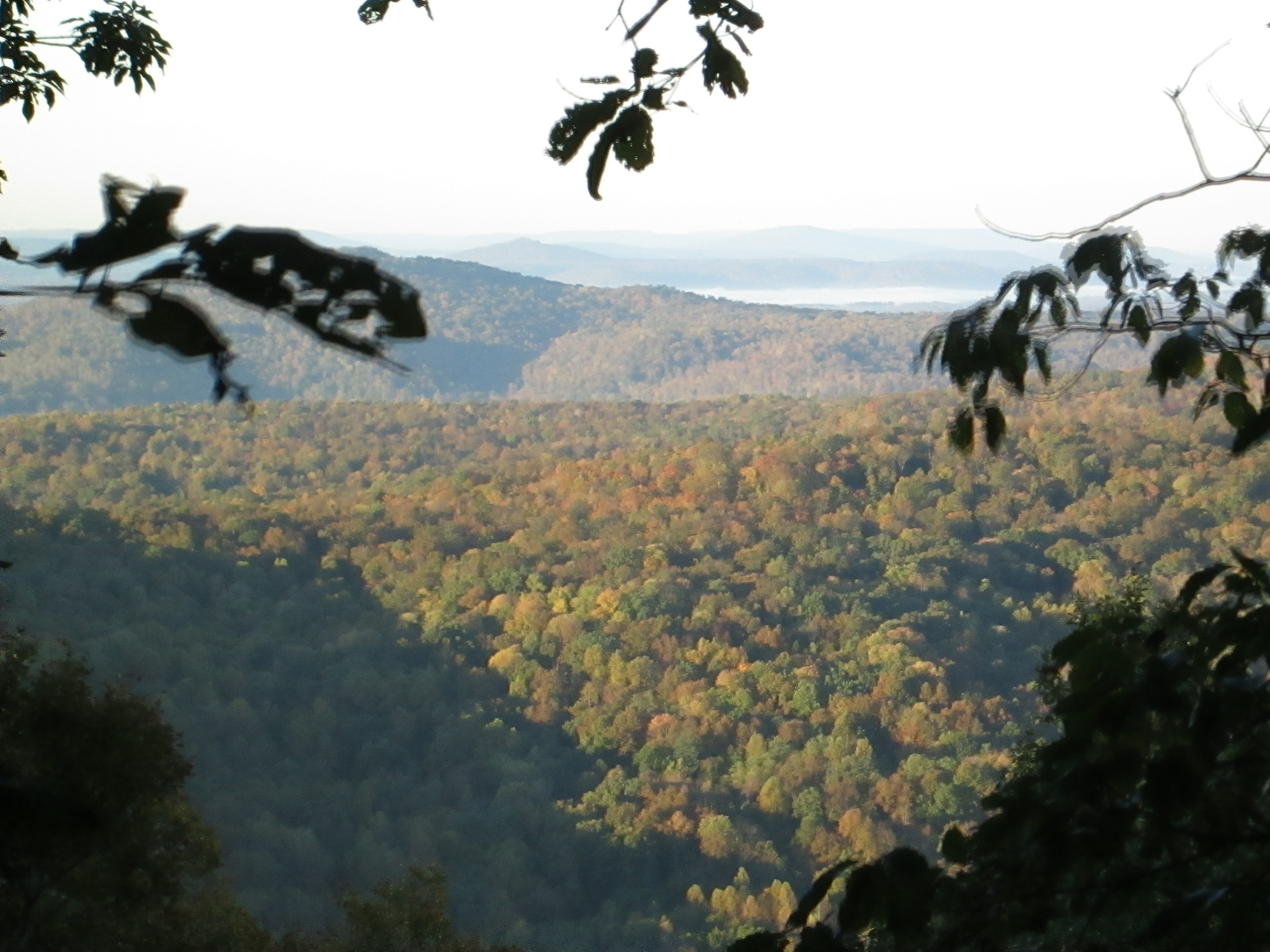
From Bon Air Mountain
[mashshare]
For a few weeks, while I drank my coffee and read the news, I would look out the window and see this squirrel sitting on a stump; he was there more mornings than not. Then I noticed for a a 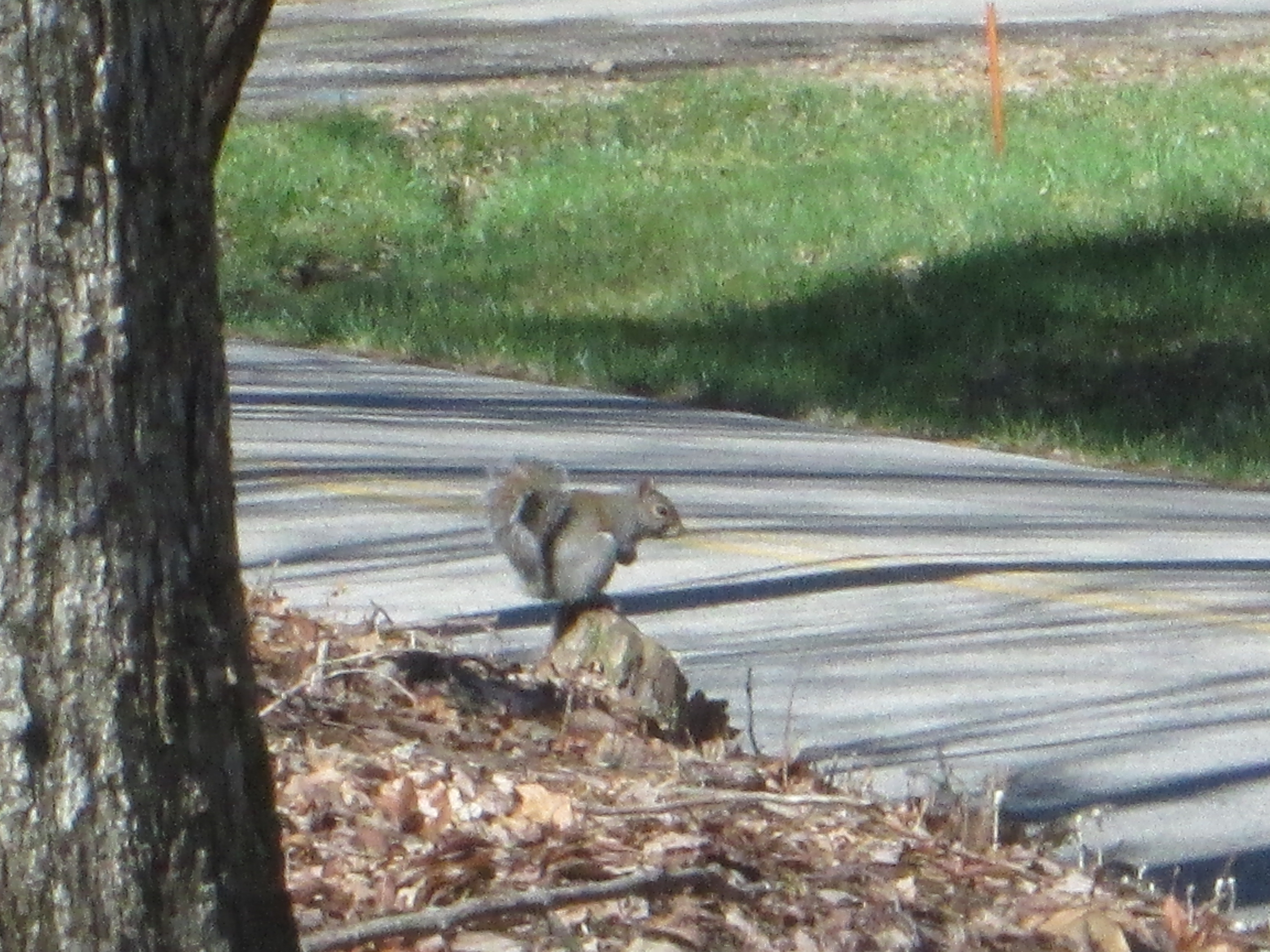 few days I didn’t see the squirrel.
Later, I was looking out the window and saw gray feathers descending like snowflakes in front of me. I went outside to see what was amiss and saw this creature not 30′ from the squirrel’s stump. I don’t know my birds well 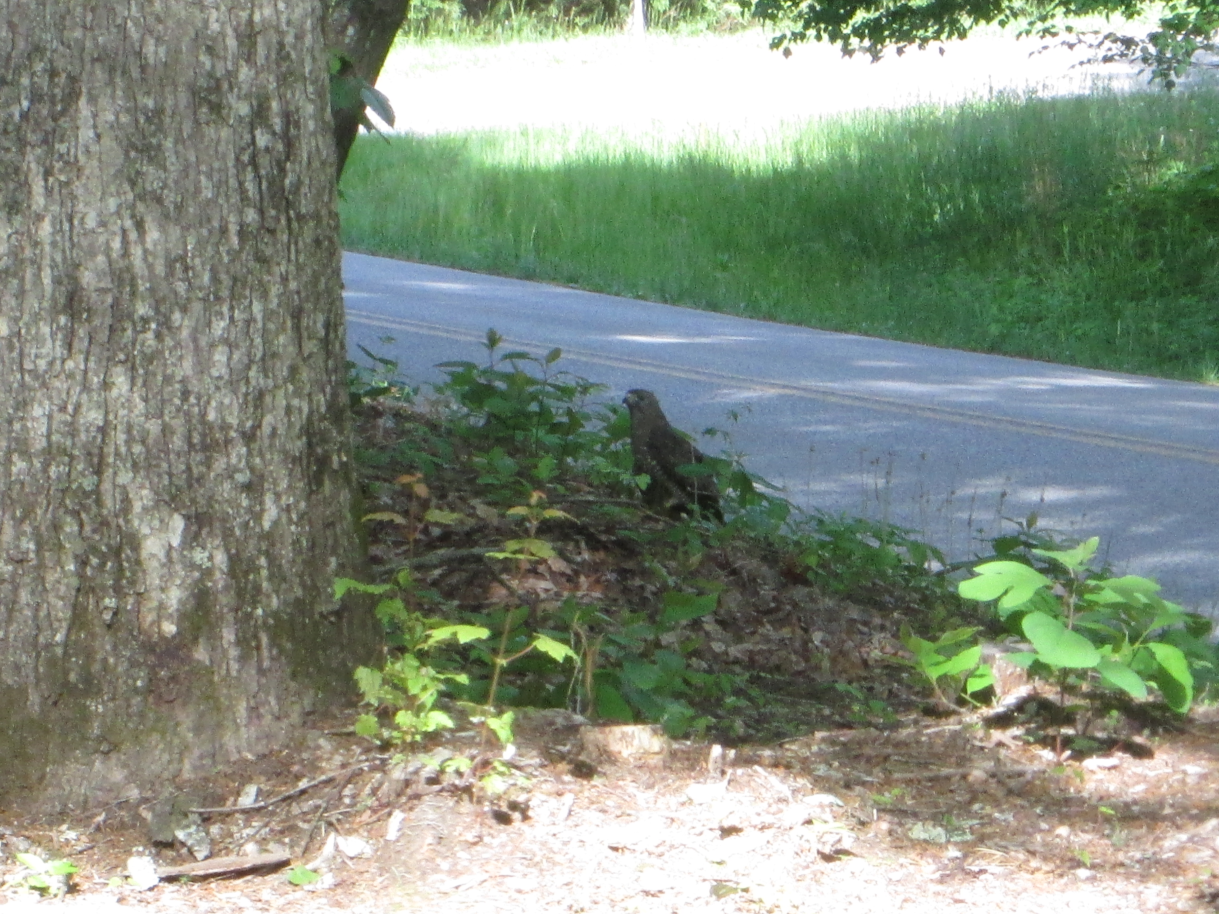 enough to identify this hawk; and I don’t know if it is large enough to take a squirrel, but it was definitely large enough to remove a dove from existence.
Some days I feel like the squirrel; some days I feel like the hawk.