Category Archives: Destination

Blue Moon, Twin Falls, Happy Trails, and Good Food

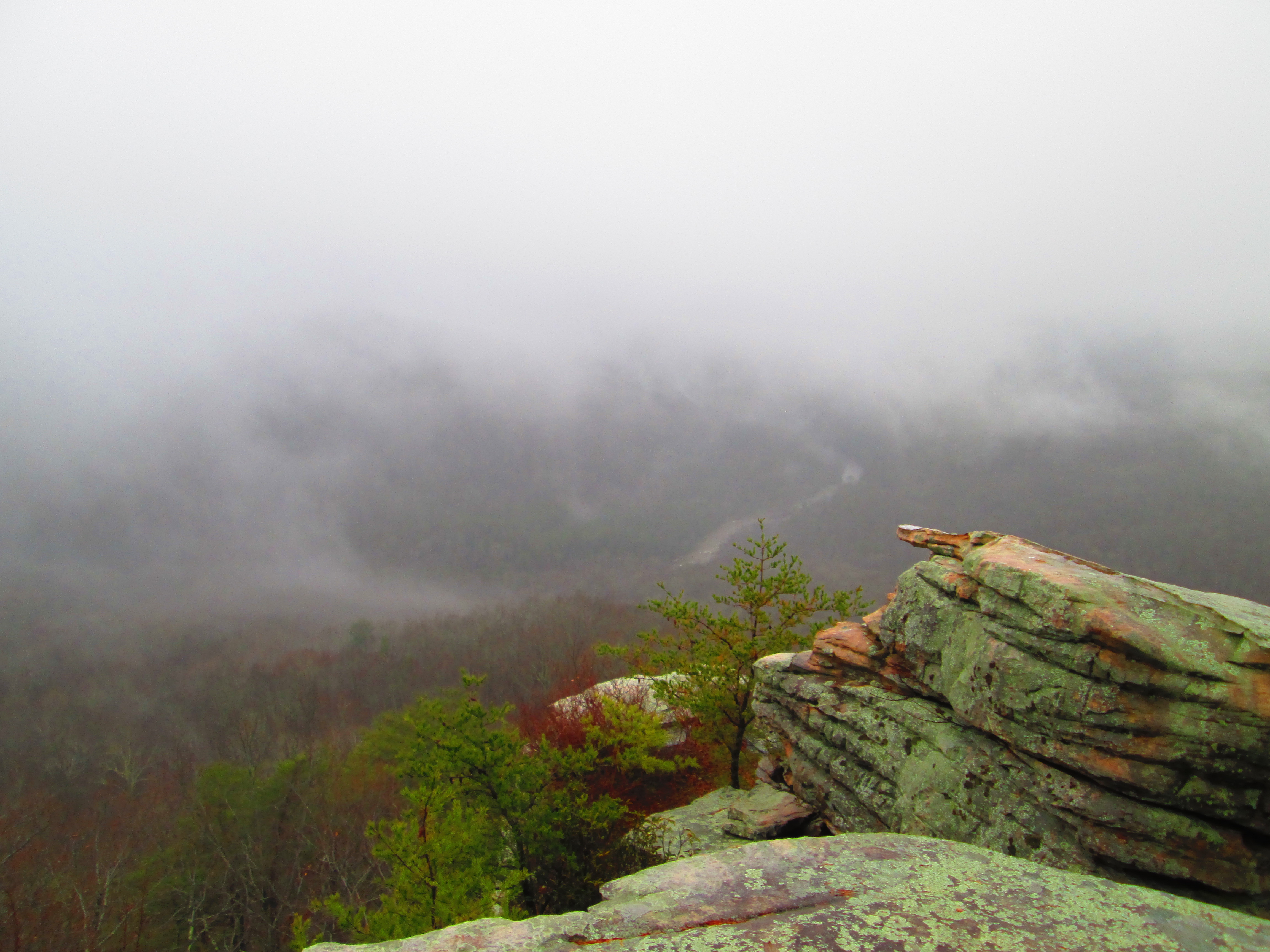
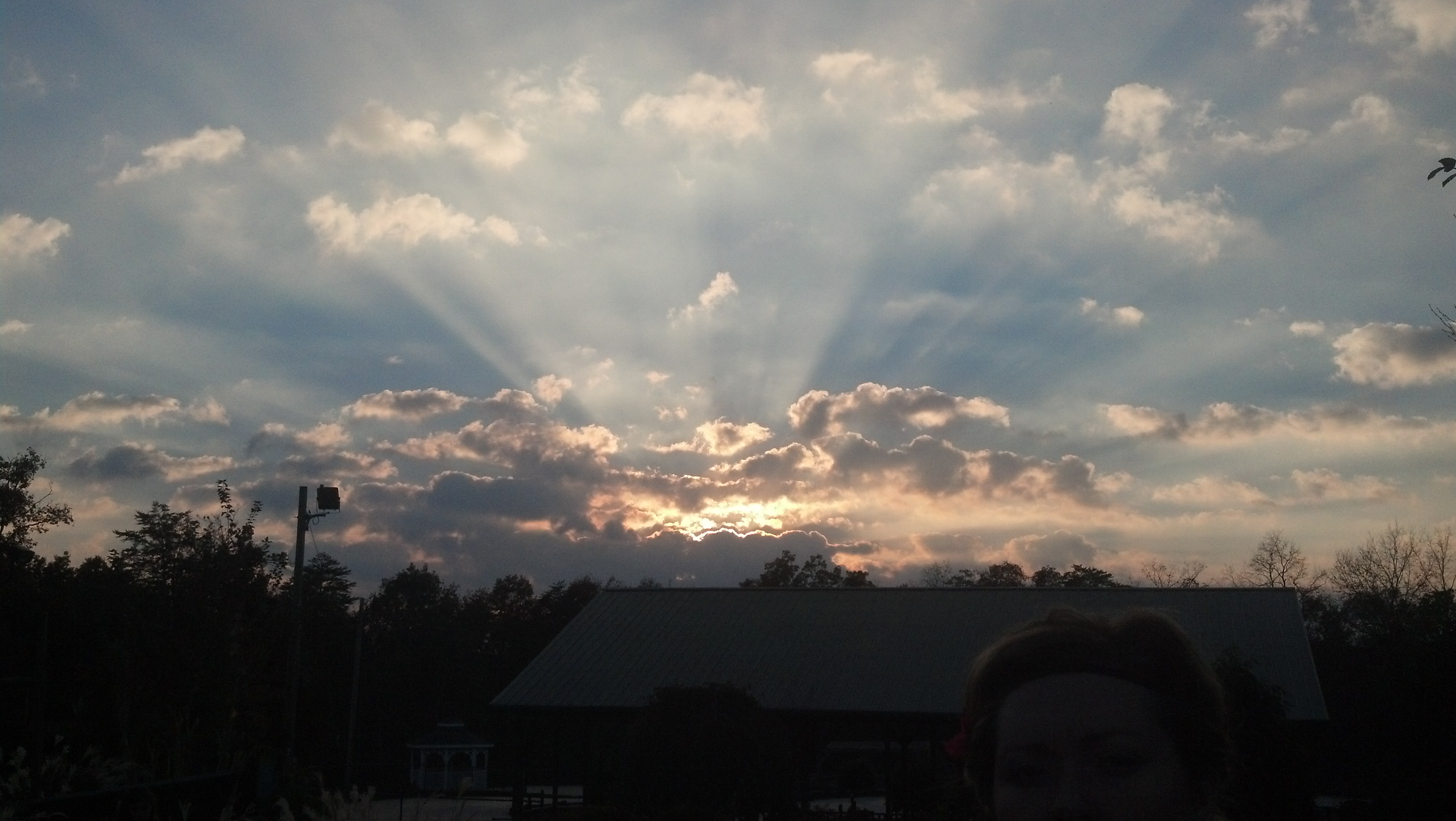
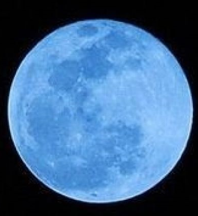
Saturday night is not only a full moon, it is a blue moon. If you think that the Twin Falls are beautiful by day, you should see them under moonlight.


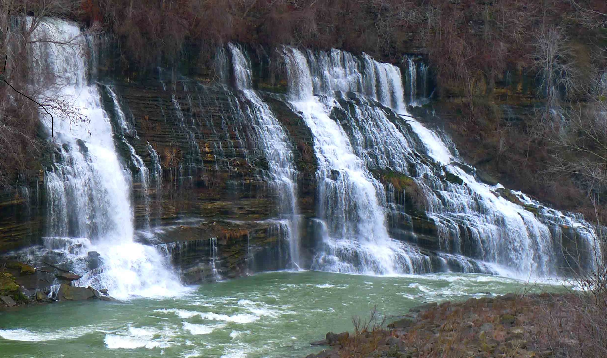
No one can tell the story better than Jennie Ivey, as published in the Sparta Expositor.

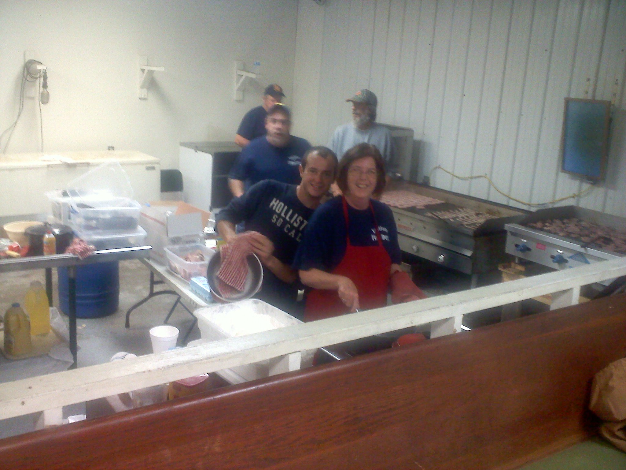
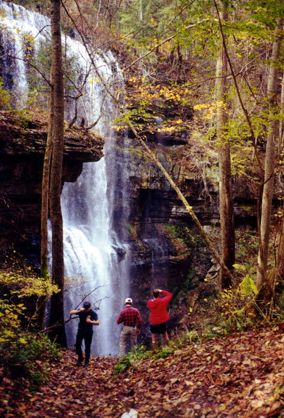
Twin Falls trails, Foglight Foodhouse, the power house at night.

By Jennie Ivey

Though these destinations don’t all have to be experienced in one trip, if you want to combine breathtaking hikes with a gourmet dinner and then top it off with one of the most surreal nighttime views ever—all in just a few hours–try this close-to-home adventure.

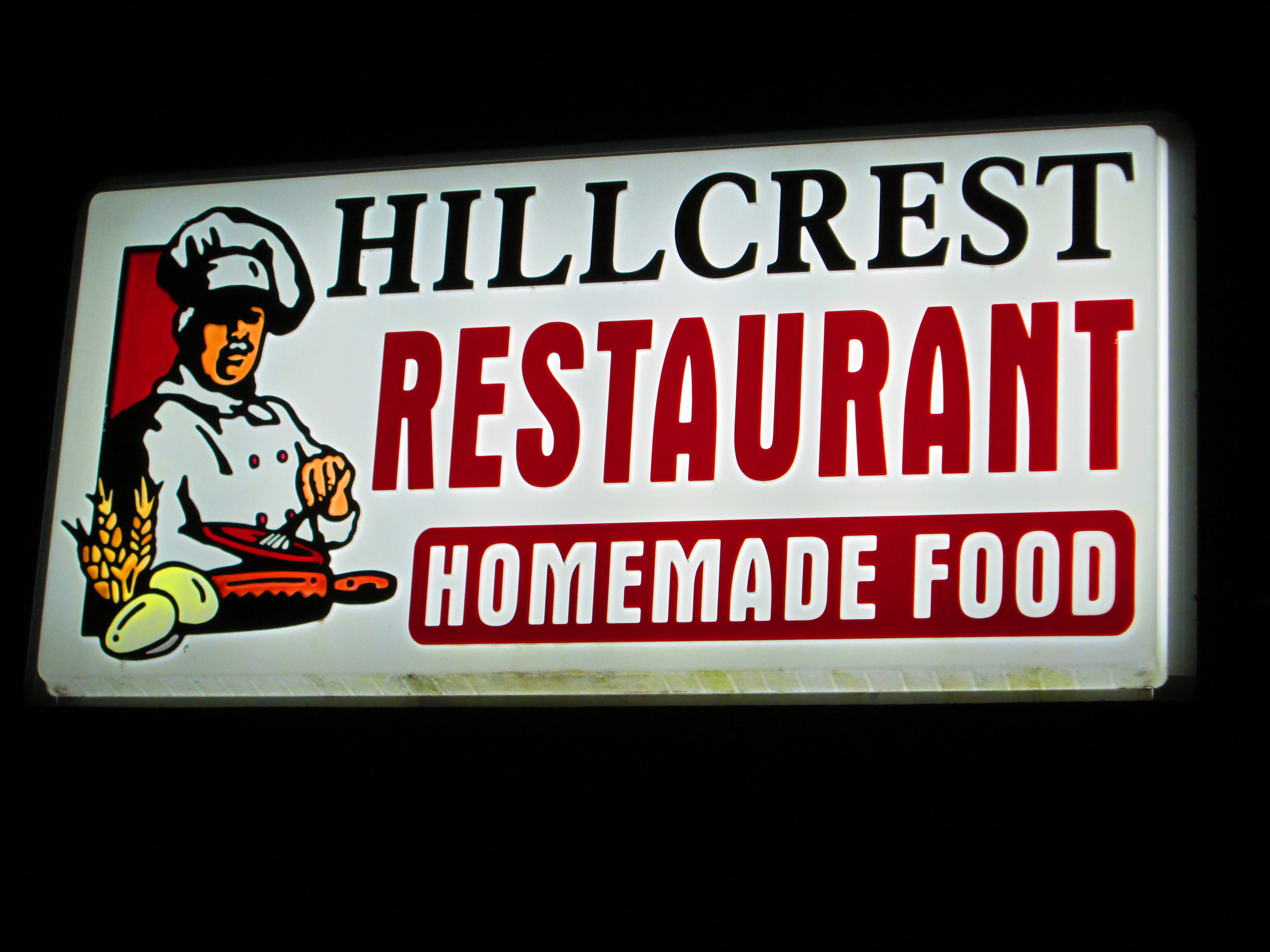
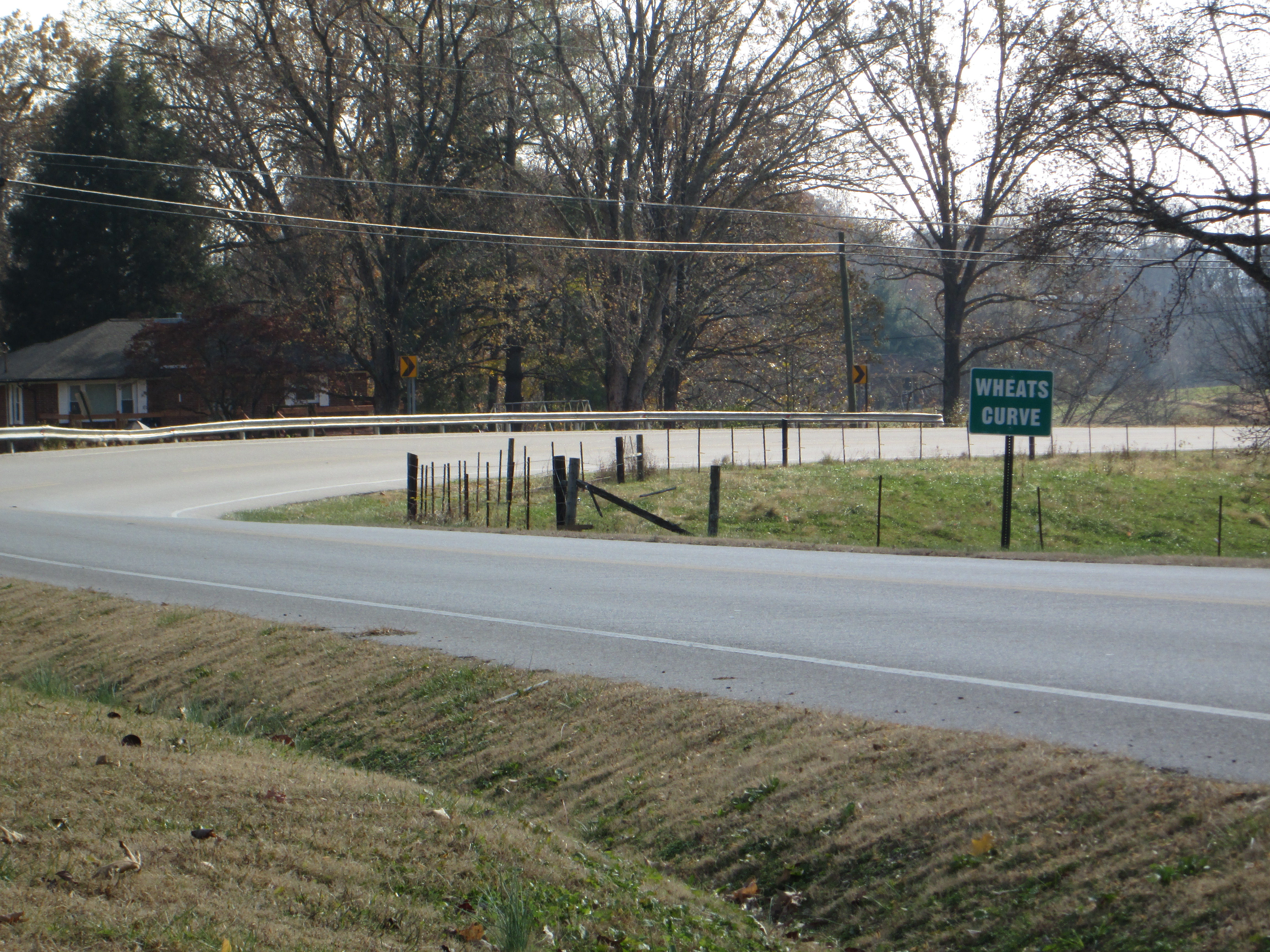
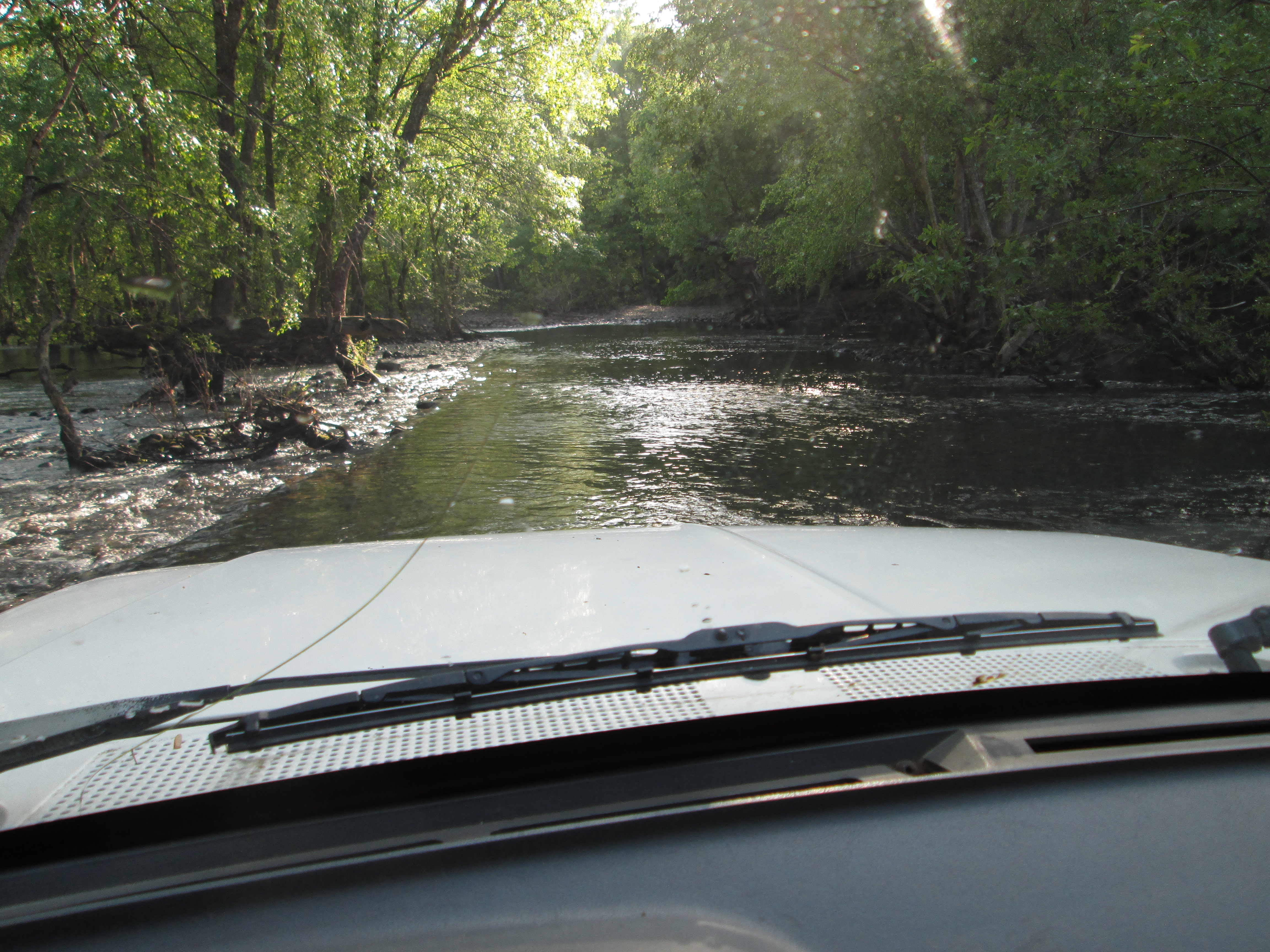
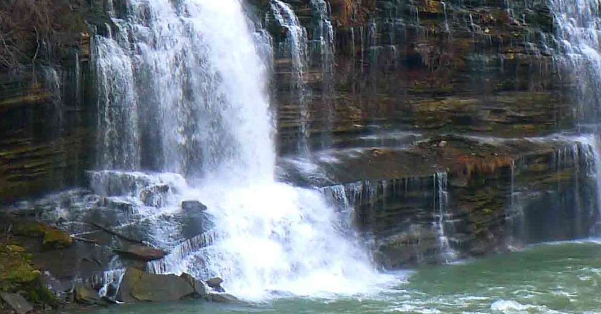
Set your GPS for 275 Powerhouse Road, Walling, TN, the address of Foglight Foodhouse. But when you get to the restaurant, drive on by. They don’t open until suppertime. Continue down curvy Powerhouse Road for a couple of miles. It dead ends—no surprise–at the Great Falls Dam power house, which you may hardly notice at first because you’re too busy gasping at the beauty of the falls.

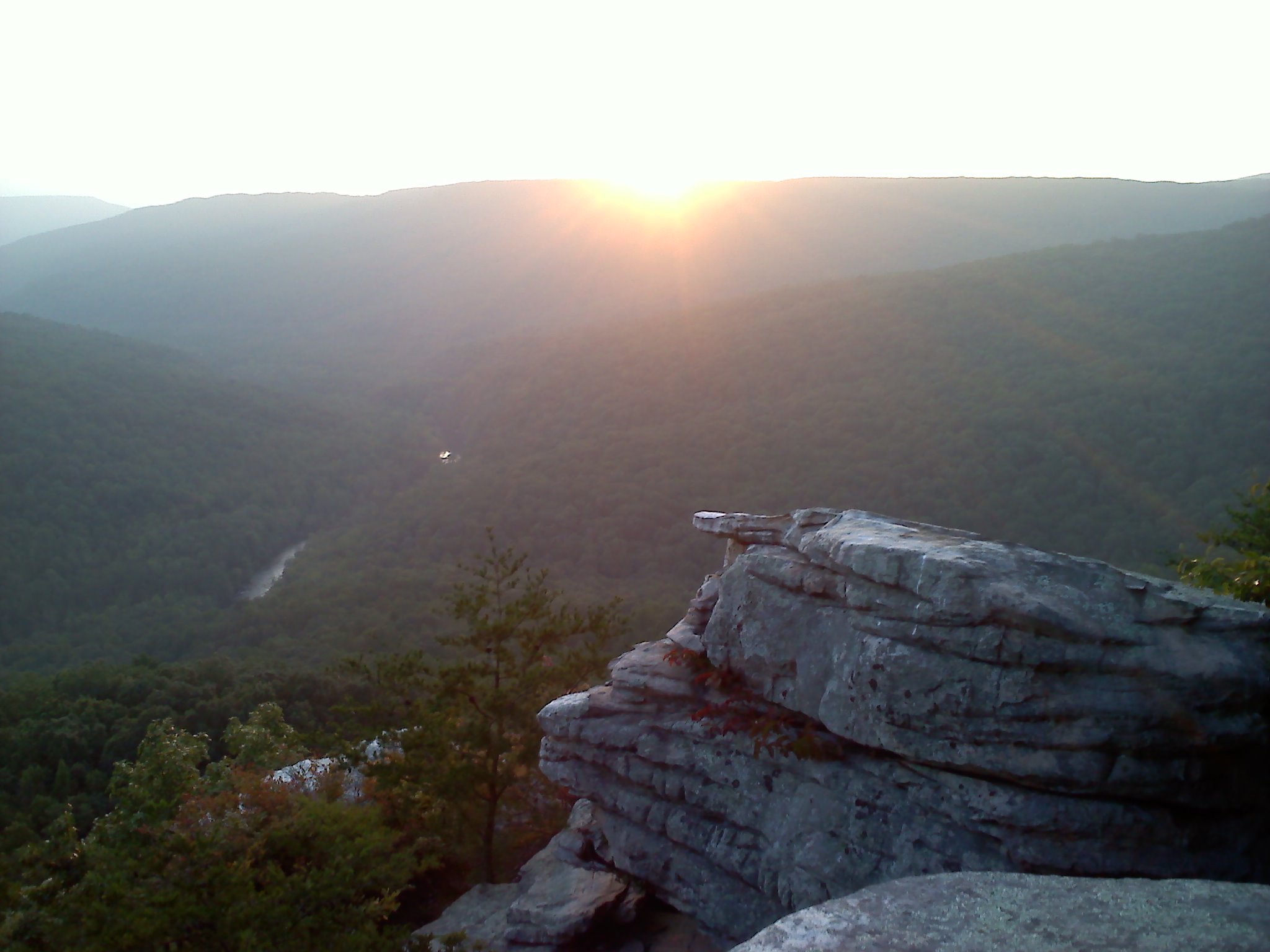
If you don’t want to hike, park and enjoy the scenery. Marvel at the cliffs and waterfalls. Watch kayakers heave colorful boats onto their shoulders and make their way down the concrete steps that lead to the river.

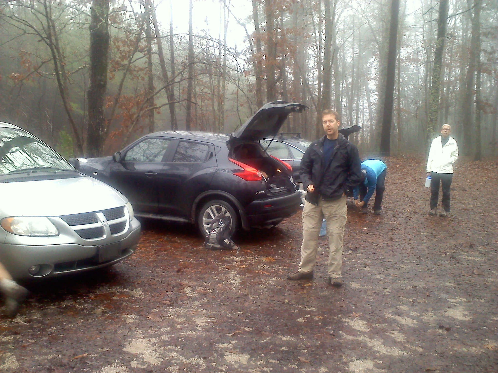
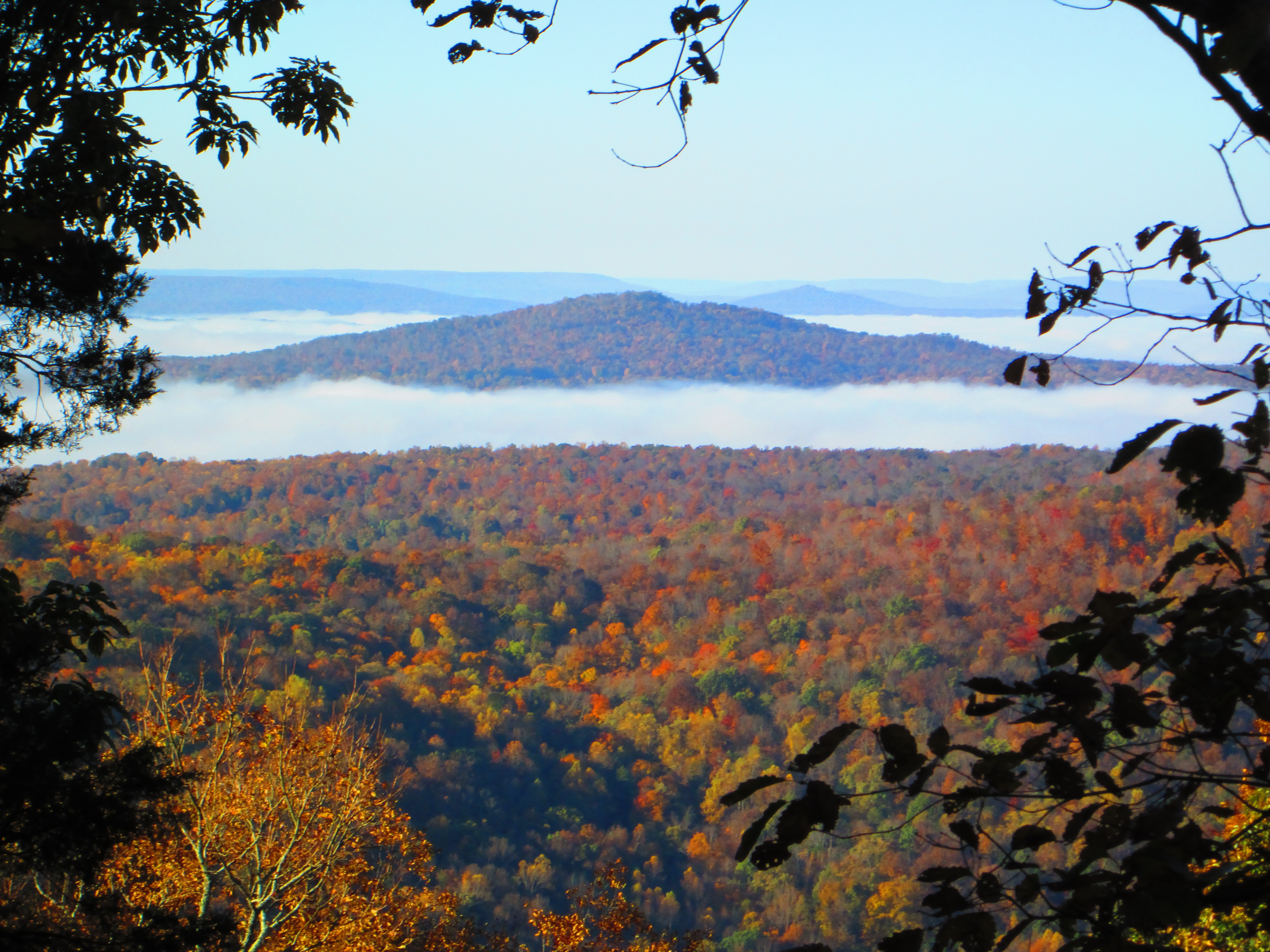
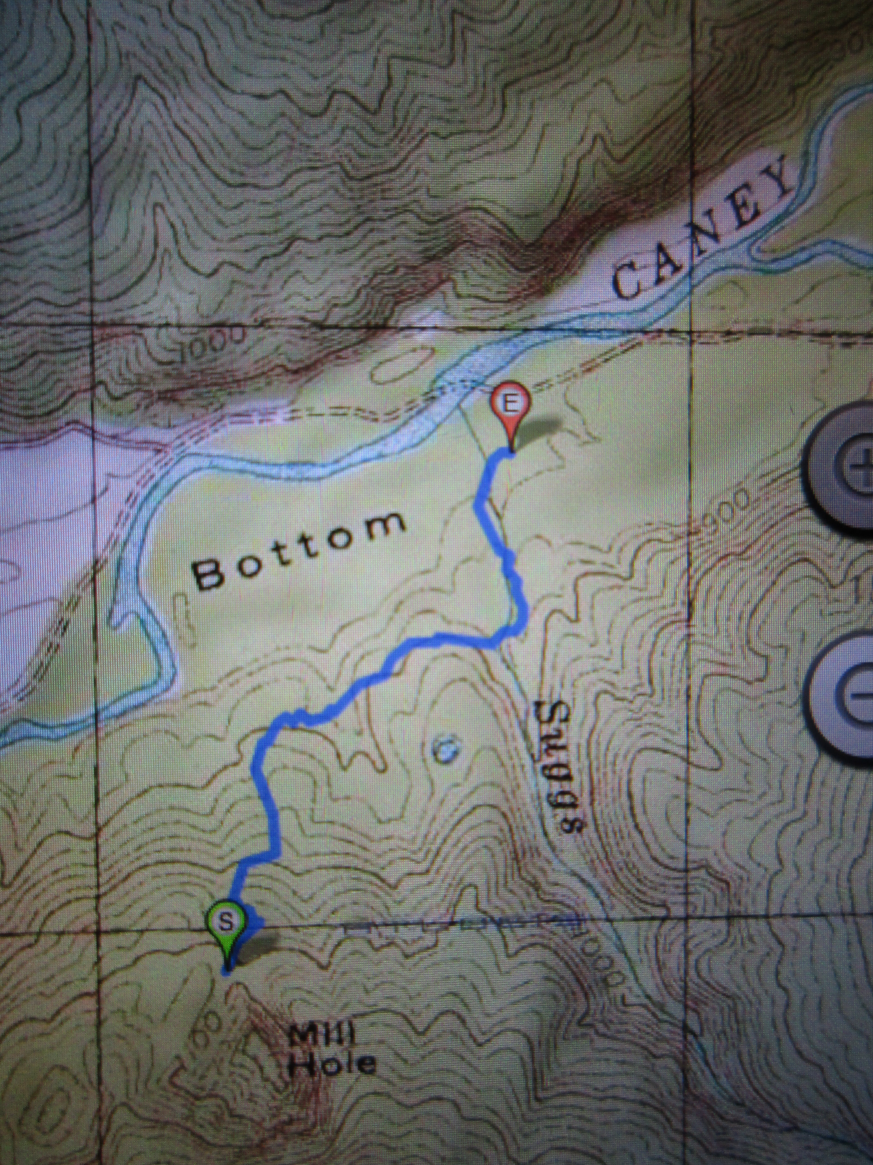
But if a walk in the woods is what you’re after, you can choose from three trails that begin in this parking lot. The Caney Fork River Gorge Downstream Trail is a 1.6 mile (round-trip) “lollipop” trail that follows a steep bluff line bordering the river. On the opposite side of the parking lot is the trailhead for the Upstream Gorge Trail. It’s 0.5 miles (one way) and provides access to swimming spots such as the “Ice Hole” and the “Warm Hole.”

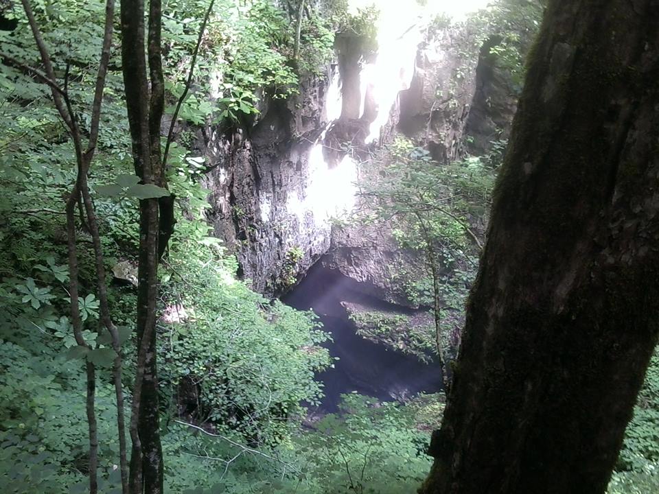
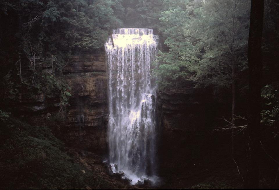
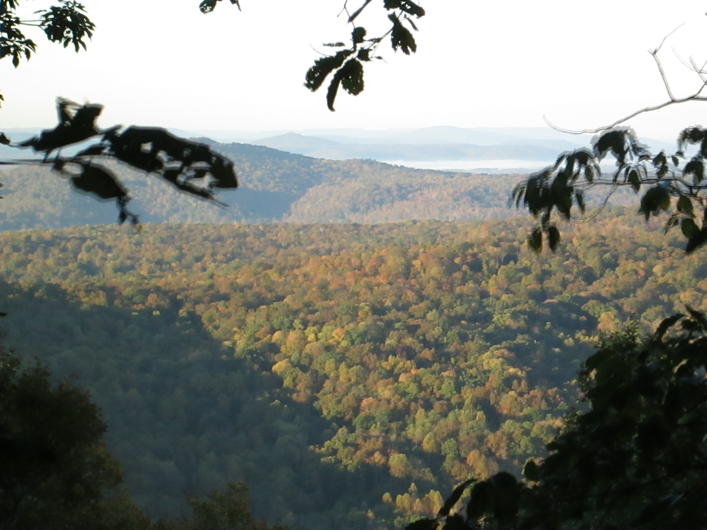
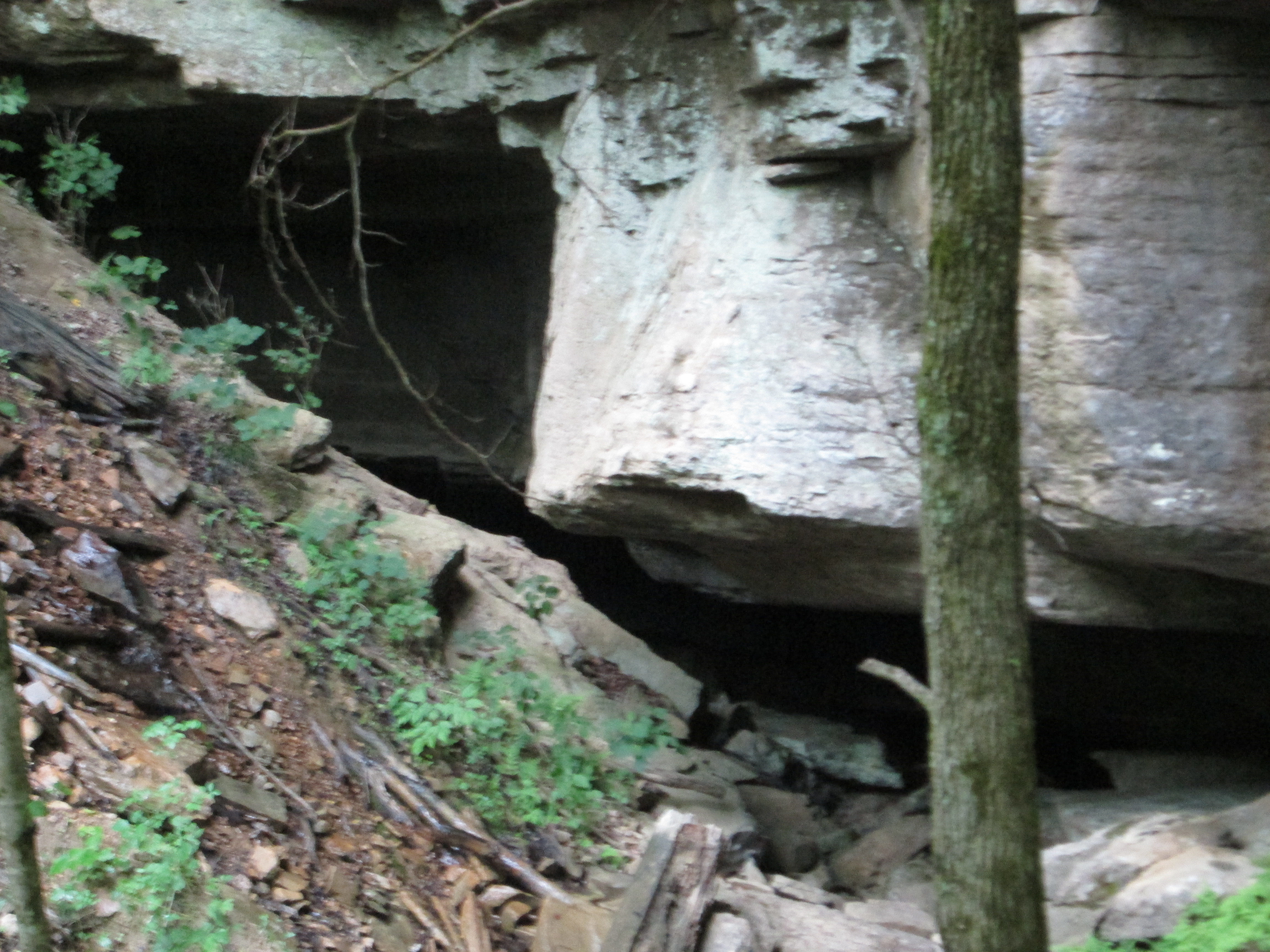
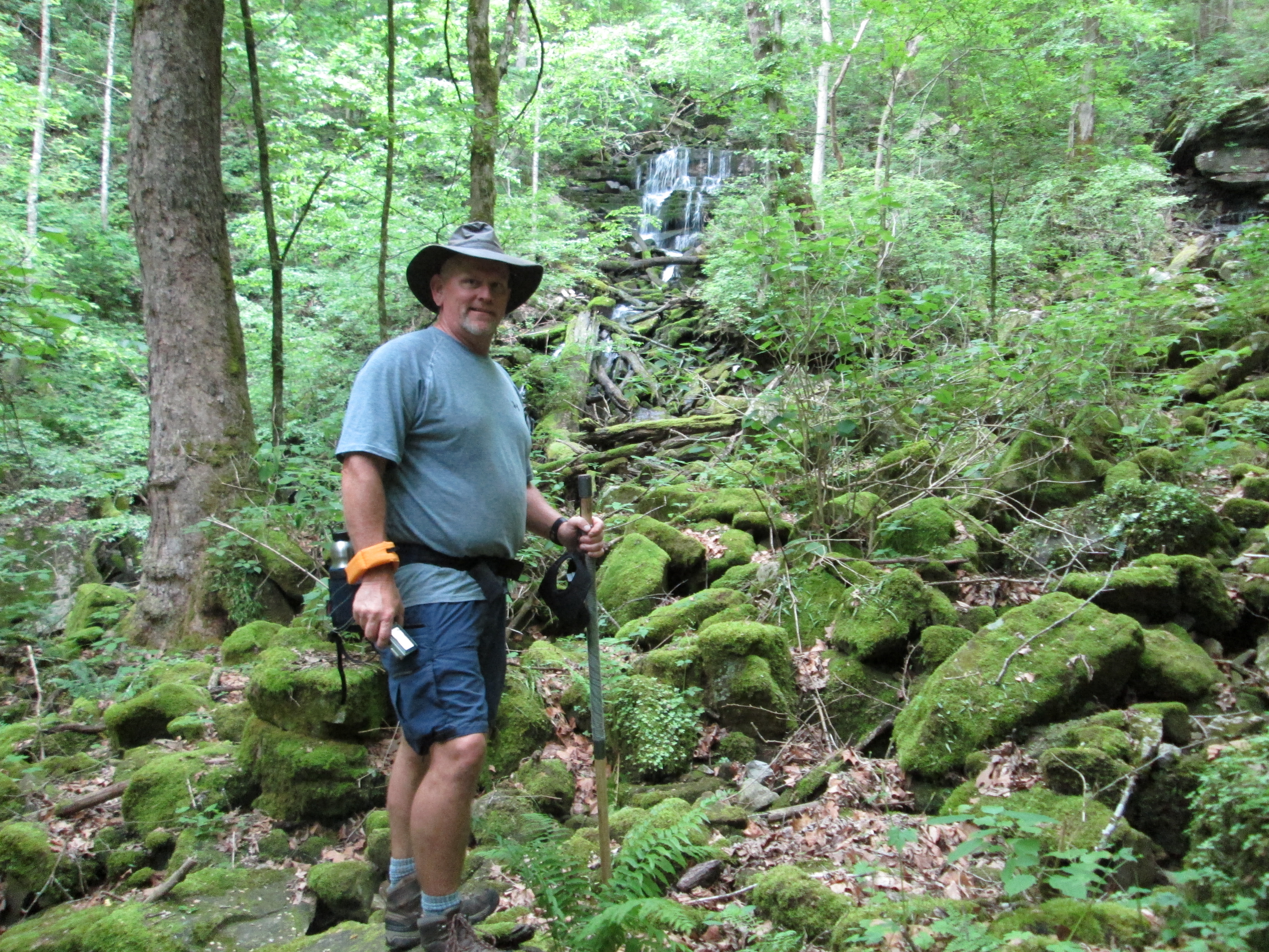
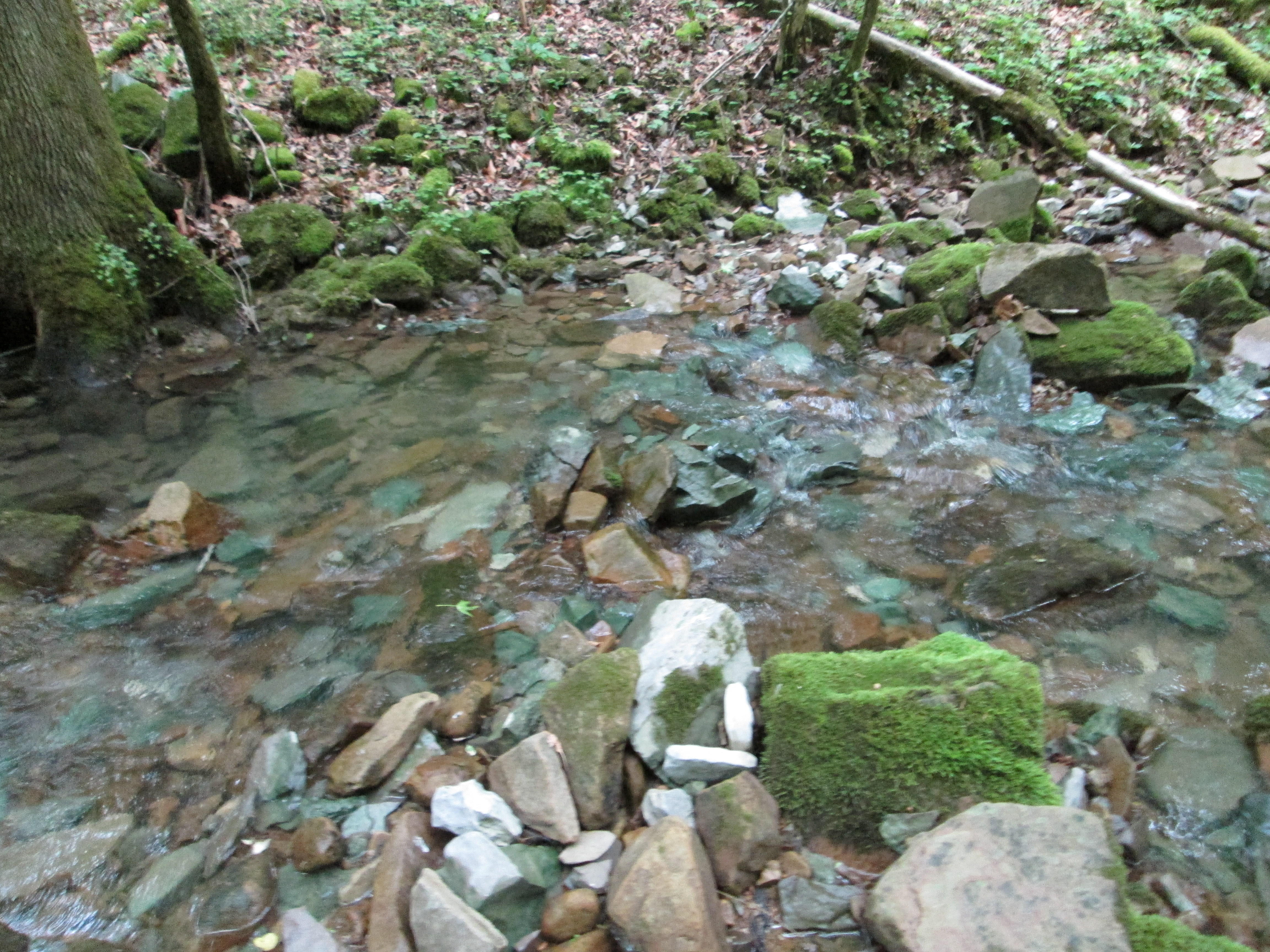
The third trail–Twin Falls Down River Trail–is a 1.6 mile (round trip) trek. Here, you’re hiking deep in the gorge, with a massive limestone wall on one side of you and the Caney Fork River on the other. In spring, wildflowers abound. The best thing about this trail? You’re pretty much never out of sight of a waterfall, none of which are “natural.” When the Great Falls Dam was built in 1916, it caused water from the Collins and Caney Fork rivers to form a reservoir. Some of the water from that reservoir feeds the powerhouse. But the water also seeps into underground caverns, leaks through the limestone and then spills into the Caney Fork River, creating dazzling cascades everywhere you look.

Now that you’re plenty hungry and thirsty, return to your car and head back up the road to the Foglight Foodhouse, which opens at 5:00 Tuesday through Saturday. (They’re closed Sunday and Monday.) The first thing you may notice as you pull into the gravel parking lot is that the covered entrance to the restaurant’s front door is actually a capsized boat. Check out the outdoor fire pit, where guests can hang out and enjoy some locally-brewed Calfkiller beer while waiting to be seated. Be sure to get a good look, just to the right of the building, at the 600-foot long railroad trestle that spans the Caney Fork River.

And then just stand still and take in the extraordinary aromas wafting through the air.
Owner and executive chef Edward Philpot, who, along with his two brothers, opened Foglight in 1997, calls the little restaurant tucked onto a high bluff overlooking the river “my lantern in the woods.” The brothers have gone their separate ways and a 5,000-square-foot building—complete with outdoor dining overlooking the river–has replaced the original ramshackle restaurant, located about a mile away. But the commitment to offering each Foglight guest a unique and outstanding dining experience remains the same as it was from the beginning.

“If you’re in a hurry for a meal,” Philpot likes to say, “you’ve come to the wrong restaurant.”

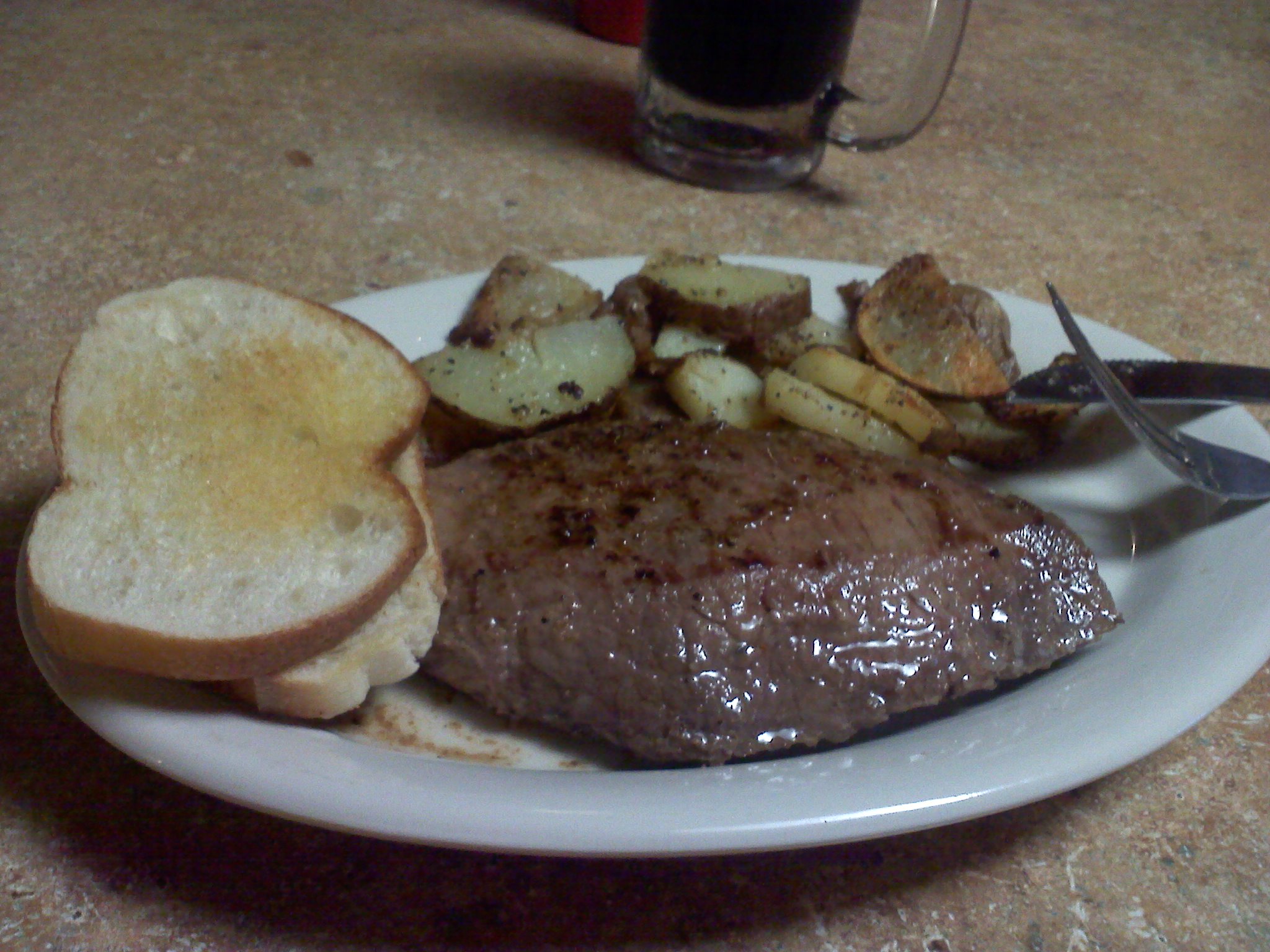
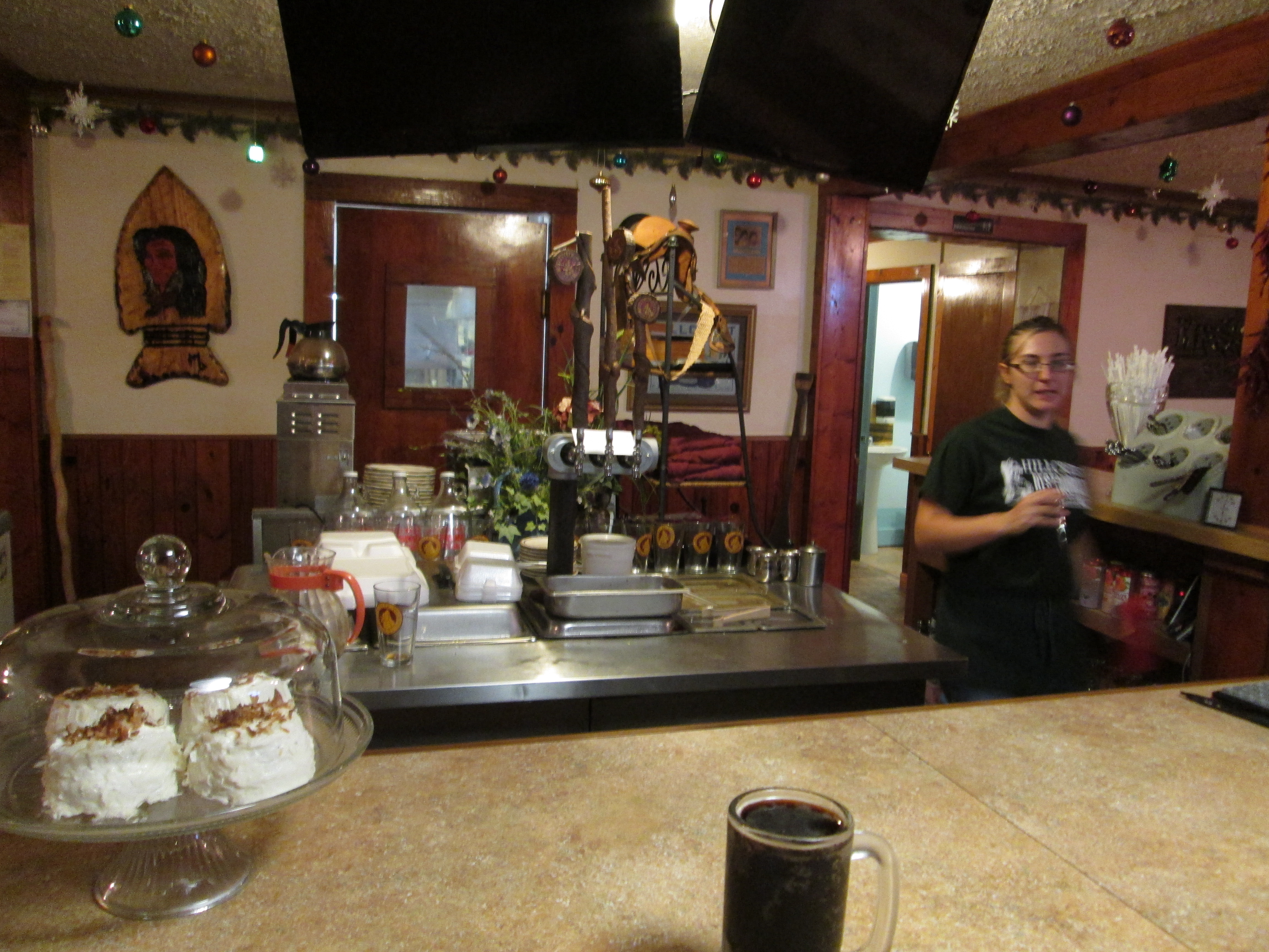
Visitors from far and near enjoy the Foglight’s eclectic menu of fresh seafood, foglight signhand-cut meats, pasta dishes, and classic Cajun cuisine. Wonderful appetizers and salads. And an ever-changing dessert menu. Coffee, tea and a variety of soft drinks are offered, as is an impressive selection of micro-brewed beer. Best deal of all? For a nominal corking fee, you can bring your own bottle of wine or spirits.

Not surprisingly, summer weekend evenings are the Foglight’s busiest time. Philpot admits that sometimes, when closing time comes and the last customer has departed, he and his staff like to meander out onto the railroad trestle just to soak in the silence and watch the moon reflect on the water. “We’re always exhausted,” he says with a laugh, “because we give 100% every night. We want to make dinner at the Foglight special for our guests every time they come.”

bluemoonIf you’re not quite ready to hit the road for home after this amazing meal, turn left out of the restaurant parking lot and head back down Powerhouse Road to where the day’s adventures began.

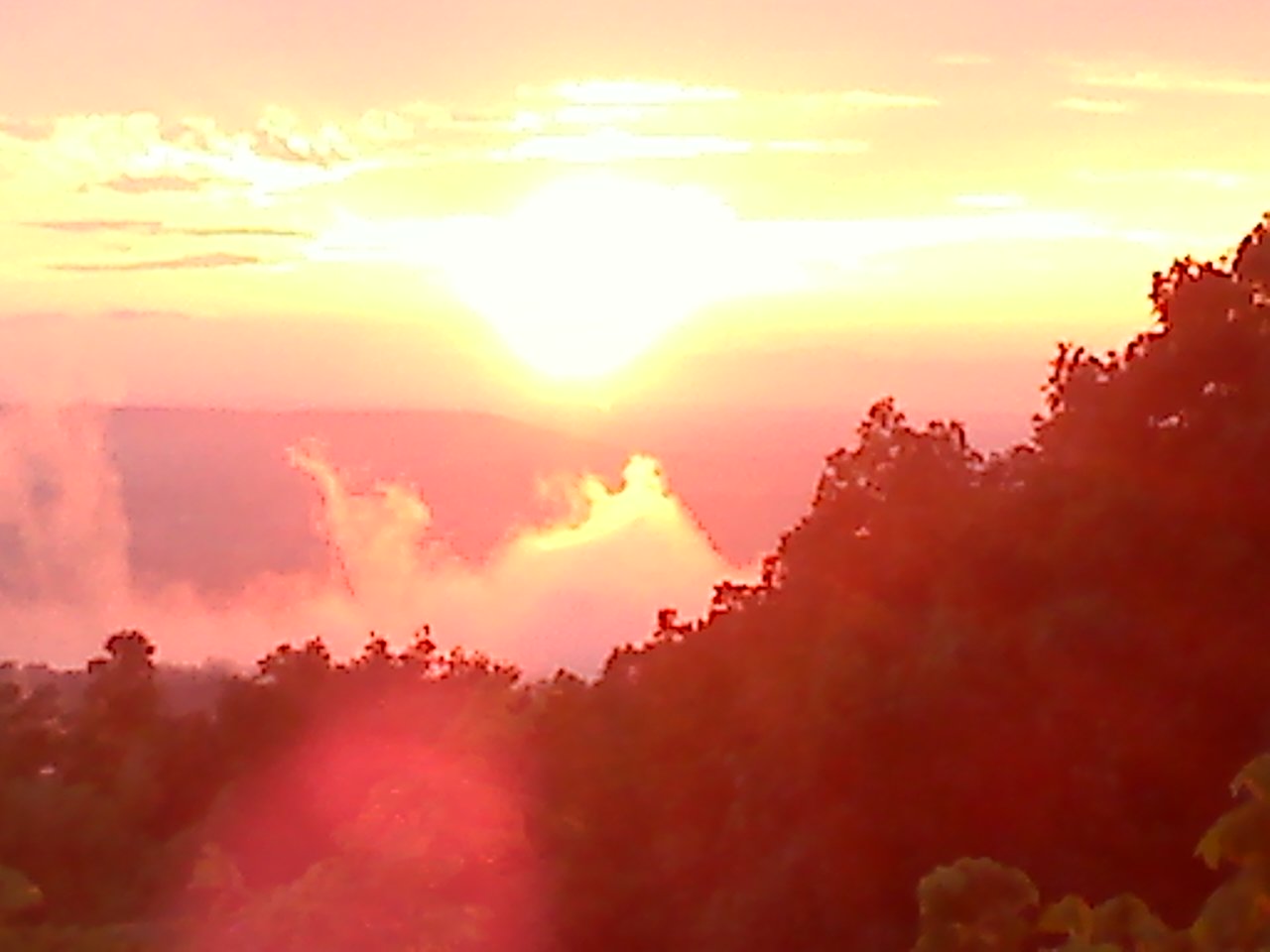
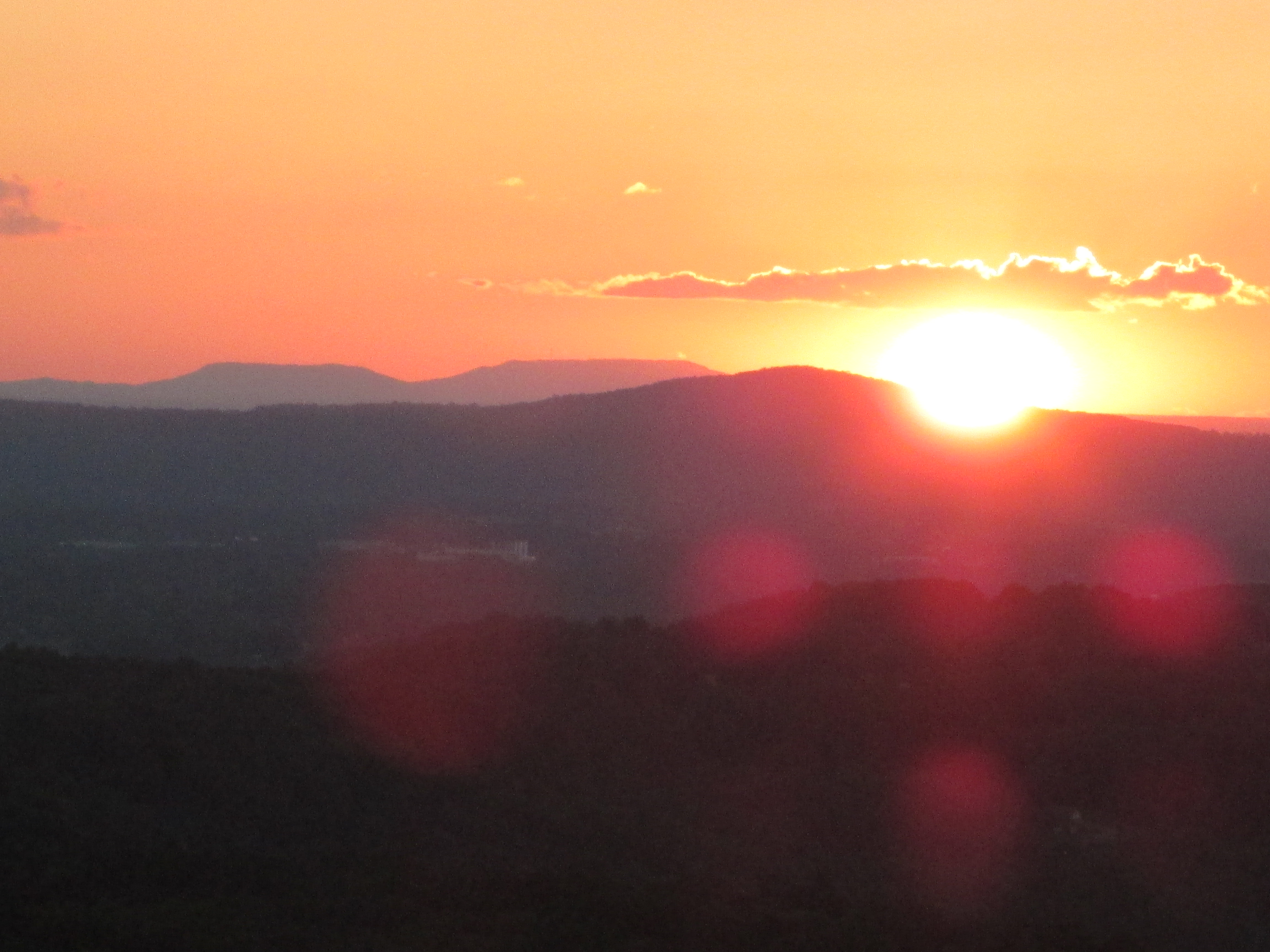
Stop when you spot the gigantic yellow glow. Is this something straight out of “Close Encounters of the Third Kind”? Have space aliens landed in Walling to take a look at Twin Falls in the moonlight? Nope, it’s only the power house, impressive by day but mesmerizing at night. If you’re lucky–or foresighted—enough to have put folding chairs in your trunk, get them out and set them up on the paved pad just above the steps that lead to the river. Notice how the glowering power plant resembles a medieval castle, complete with moat and drawbridge. Relax and let the cool evening breeze blow across your face. Smell the damp earth. Listen to the roar of the falls.

It’s the perfect ending to a perfect day. Right here in White County, Tennessee.

[mashshare]

Saturday in Cragrock

Well disguised as a sleepy little town, Sparta TN has a lot going on, regardless of weather. For instance, Saturday, December 6, one could stay busy with a multitude of activities, many of them free.

0700 Saturday, breakfast at Eastland Fire Department. Many local fire departments conduct these breakfasts as fundraisers. Almost always these volunteers include a choice of country ham,

Carolyn Holland is a paradigm of why they call this the Volunteer State, cooking for the Eastland Fire Department.

bacon or sausage; unlimited eggs, biscuits, gravy (sometimes even red-eye), potatoes and most importantly, coffee and camaraderie. ALL FOR $7.00? Cracker-Barrel eat your heart out. If you want to meet the who’s-who of the community, show up for some of these events. Local, and state leaders often attend these venues to listen to our concerns. Perhaps the only thing better than the food that you are eating, is that you are also helping a good cause.


Eastland Fire Department interior

Piggin out at the Eastland Fire Department

Eastland Fire Department Country Ham Breakfast

Eastland Fire Department Country Ham Breakfast


Welchs Point on a beautiful rainy day

Welch’s Point, beautiful – – even on a rainy day.

0830 Saturday, Welch’s Point. Yep, it’s rainy, foggy, cold – – but still beautiful. As I passed by the Virgin Falls parking lot, this was the first time I had seen it empty on a weekend in years; someone could have that entire trail to themselves today. If you’ve never hiked in the rain, don’t worry; your mom lied – – you won’t melt, and you won’t catch a cold. What you will experience is a peaceful trip. With the white-noise provided by the wind and rain, you may find yourself getting closer to deer and wild turkey than you have ever been. You will see cascades that are only there during the rain; brooks swell into creeks and the creeks into small rivers. Most hikers never experience the subdued light that can only occur on a rainy day. The forest takes on an entirely different ambiance – – it’s like being on the same trail, through different terrain.

Welch’s Point is known as one of the most spectacular overlooks in the state. On clear days you can see for miles; on foggy rainy days you stand above a good portion of the weather and peer into an ever-changing landscape. As the clouds blow through the canyon, you go from moments of clarity where you can see into Van Buren County; to instances where you can barely see the rocks underneath your feet. You will hear increases of rain long before the shower gets to you, and you might be surprised that minutes later, the rain is gone and you can see miles and miles again – – only now, the air is even fresher than before. In lighter rains, larger birds often continue to soar. I suspect that being savvy hunters, the birds of prey are taking advantage of distracted squirrels and rabbits that on days like today aren’t forewarned by shadows and they can’t hear the air-assault because of the gentle rain.

Intrepid Hikers at Virgin Falls

Intrepid Hikers at Virgin Falls

As I left Welch’s Point, I met four cars pulling into the Virgin Falls parking lot. All of them were from the Nashville area and the occupants were not intimidated by the weather; after talking to them for a few minutes, I could tell; they were eager to enjoy that trail to themselves.


1030 Saturday, it is small business Saturday in Sparta Tennessee. A number of businesses are catering both their wares, and free yuletide snacks. Hot chocolate and cookies at one store, hot apple cider and cheese balls at another, popcorn here, brownies there, and there may even be a little Calfkiller (and I don’t mean the river) floating around as well.

Music at Oldhams

Music in Oldham’s Theater

Musicians are standing in line for their turn to play in Oldham’s Theatre (and it’s free). The upstairs of the American Legion building is packed from wall-to-wall with craftsman and their crafts. One of them is selling GREAT theme birdhouses for only $10; these are made of real wood, cleverly painted, and made here NOT China. How can someone work for hours and make beautiful, truly unique jewelry and sell a pair of earrings for $5. I asked one craftsman if they had anything with a ladybug motif. She pulled out a box that had tiny beads that were shaped and painted like ladybugs. She custom-made a pair of earrings for $5. Last year I got over half of my Christmas shopping done on this day; I put a pretty good dent in it this year was well.

1300 Saturday, its Christmas on the Mountain weekend at Fall Creek Falls. One of my favorite drives anywhere is Cherry Creek Road, to 285, and the back way to Tennessee’s most-visited state park. 285 is a narrow ribbon of pavement surrounded by mountains and bordered by Cane Creek for a good portion of the drive. The creek has become a raging river by this time and it runs so close to the road you can hear it above the rain. I’m now under the clouds that I was above while at Welch’s Point just a few hours ago. Mountain tops disappear and reappear as the low-lying clouds collide with the surrounding hills. I had to pull off the road and just watch the scenery change as I sat still.

Now I wish I hadn’t eaten so much at the Eastland Breakfast and downtown Sparta, but I manage to

Fall Creek Falls Inn during "Christmas on the Mountain"

Fall Creek Falls Inn during “Christmas on the Mountain”

choke down samples of homemade intense dark chocolate, peanut brittle, and locally boiled peanuts. The Inn at Fall Creek Falls also has a line of musicians (hey, we are in Tennessee) waiting to perform on their stage. You can hear the ever-changing music in the background as you walk through conference rooms full of competing craftsman. I’ll remind you that even with the rain; there were only three parking spaces available in the Inn’s large parking lot.

1900 Saturday, Hillcrest Restaurant. With this much to do, this was a long day. The huge breakfast, and scads of snacks have worn off. Besides, it gets pretty lonely on Bon Air Mountain. My favorite

Hillcrest Reataurant, near Center Hill Lake.

Hillcrest Reataurant, near Center Hill Lake.

restaurant is just over 20 miles from my home and well worth the drive. The Hillcrest Restaurant has been through many iterations, but this is the best one yet.

Where else can you get a huge flank steak cooked to order and two sides for under nine dollars – – yep!  They also have three flavors of Calfkiller (and I don’t mean the river), and deserts that are as good as I’ve had anywhere. The service is great; sometimes they’I have a wood fire burning. During the spring and summer, Hillcrest hangs humming bird feeders outside their picture windows and I think that all the hummers that leave Brazil must have heard of the Hillcrest. The entertainment of those birds buzzing just outside the window is a draw unto itself – – it’s like an aquarium for birds.

If you’ve read my food reviews before you know that I have a ratio of quality to price – – this is a TEN. I don’t know of any better “bang for the buck” ANYWHERE!

Huge Flank Steak and sides for less than nine dollars.

Huge Flank Steak and sides for less than nine dollars.


Hillcrest Restaurant near Center Hill Lake.

Hillcrest Restaurant near Center Hill Lake.


Just another rainy day?   Not in CragrockUSA.

[mashshare]


What’s the story behind Wheat’s Curve?

2014-11-14 14.29.13

Wheat’s Curve

Wheat’s Curve, the rest of the story.  Just outside of Sparta TN,  There is an interesting twist in the highway listed on many maps as The Broadway of America. Also-known-as US 70, this was the first paved road in the United States to reach from the Atlantic to the Pacific.

As a rule, road builders try to make highways as straight as possible. So when you encounter an almost right angle in a highway, you know that there must have been a reason. This bend is so pronounced that someone erected signs announcing (or warning) its position. Dubbed “Wheat’s Curve” for the family of Morgan Wheat who lived along the cusp, this curve has continued to slow traffic for the better part of a century.

Of course, for a segment of the population, a curve notorious enough to have its own moniker becomes a dare. It has been the site of many accidents through the years, some were sincere mishaps; others were caused by waging on who could travel the fastest through the curve; and of course, this has been the site of many traffic fatalities.

The alleged Wheat’s Curve speed record was set by a moonshiner who made the quarter-circle at 105 miles per hour. Interestingly, yet another segment of this same highway and still in Tennessee is where the story that became the movie Thunder Road took place.

Along with the sadness of the injured and the killed are a few anecdotes that have humorous twists. Ricky Mcbride remembers standing by the guard rail waiting for a school bus when a truck carrying pigs overturned unleashing startled swine that soon covered three subdivisions. Ann Holland recalls that incident and adds that the neighborhood children made sport of trying to catch the little pigs.  Carless Wiinnett remembers a similar day when a chicken truck overturned.

Civil Engineers spend years learning to calculate trajectory for vehicles likely to travel a given road so there must be a compelling reason to include a sharp change in direction at that locale.  We may never know for sure, but after studying maps of the area, and noting that the Louisville & Nashville

L&N Railroad Map. Note that Bon Air and Monterey predate Cookeville and Sparta

Railroad spur, that had been built decades before takes a similar turn in the same area; I think we might be able to deduce the reason for the curve. Apparently underlying geology resulted in these speed-breaking turns for both the highway and the railroad. White County Tennessee has more caves than any other county in the entire USA. Both the railroad and US 70 converge, just south of Sparta, on a ribbon of stable land bordered on one side by the Calfkiller River, and one the other by a huge, cave-induced depression called a “sink”.

Note the topo-map below. The contour lines illustrate elevation change. The contour lines that have tick-marks denote the geologic anomaly known as a sink. The tick marks point inward, and as you can see, this sink is probably over 3000′ long. Sinks are avoided for construction purposes because they flag unstable earth. Engineers for both the railroad, and the highway sought to avoid the mountains to the west, the river to the east, and at all cost, they skirted that unstable land in the sink. The cost of avoiding those three natural wonders was a temporary reduction in speed on both the rail and the pavement. Wheats Curve topo

2014-11-14 14.30.08

JR’s Place in Wheat’s Curve

One more good reason to slow down at Wheat’s Curve is JR’s Place. Known for ages as Webb’s Package Store, and operated for decades by WWII POW, Carl Webb and wife Margie.  Jimmy Ray Cantrell purchased the business last year and has converted it to a friendly tavern complete with a great selection of brew, karaoke, and various entertainment offered by local talent. I suggest that you try the “Third Shift” beer, but watch out for the boiled eggs that are soaking in napalm – – but I guess that fiery flavor sells a lot of brew.

2014-11-21 19.01.37

Cheers


[mashshare]

Virgin Falls

Photographer unknown . .

Virgin Falls, near Sparta TN, is the crown jewel of trekking beauty. The creek feeding Virgin Falls comes out of Little Chestnut Mountain, runs about 150 feet, plummets 110 feet, and disappears into the same mountain from whence it came. Rumors have it that no one knows where the water comes from or where it goes – – I know the source and hope to be able to announce it in the upcoming months. Perhaps, one of the most unique things about the lack of a visible creek entering or exiting Virgin Falls – – is that Virgin Falls is not so unique; there are four other waterfalls within five miles that similarly do not have streams leading to them, or out of them. The second most popular is known as Lost Creek, the falls where the remake of “The Jungle Book” was filmed.

Part of the intrigue about visiting Virgin Falls is the considerably-rugged 4.8 mile trail leading to the namesake of this wilderness area. The first third of the trail is rough which unfortunately makes the last third even rougher. The majority of the 1300’ elevation change that takes place along this trail is within the first 1.5 miles of the trail head. Thus, when returning, you are climbing out the last third, not to mention the first mile includes a stream that is often not fordable without getting wet.

Big Laurel Falls by Chuck Sutherland

Big Laurel Falls by Chuck Sutherland

One saving grace about this rugged trail is that there are two more attractions that you encounter while venturing to Virgin Falls. either of these attractions alone would make it worth the trip. The first is Big Laurel Falls. Big Laurel Falls is the result of the above-mentioned stream that just drenched you while you were fording it, dropping over the mouth of a sizeable cave entrance and disappearing into that cave – – thus there is no downstream after the falls – – and this is often a huge volume of water.

Sheep Cave, courtesy Tim Wooton

Sheep Cave, courtesy Tim Wooton

The second “main” attraction along the trail is Sheep Cave. Sheep cave rests in a mysterious looking sink that somehow invites you to drop off the main trail and check out the bottom. The descent is steep, but can be done without rope; however, you are going to wish that you had a rope on the return.

Lastly, is the waterfall that gave this wilderness its name, Virgin Falls. There has not been a season when I’ve seen this falls that it is not spectacular. Once, in the winter it had been below freezing for five days. The trip in was almost like a black and white movie; mostly devoid of color. But, with the leaves off the trees you get to see some beautiful karst topography that you don’t get to see otherwise. And, after several days of temperatures in the teens, the mist rising off the warm water from the cave freezes on every plant stem within thirty yards of the falls. When the sun hits it, it is like looking at a giant glass menagerie and sometimes the refraction is blinding.

Virgin Falls, courtesy Ross Cardwell

Virgin Falls, courtesy Ross Cardwell

“But wait, there’s more.” There are two three more side attractions that you should see while you are at Virgin Falls. The first is, while at the main falls, take a few minutes to hike down to the headwaters of the Caney Fork River – – if you are lucky enough to have a fishing pole, even better. The second side-track is  a spur trail that leads off the main trail up a steep ascent to Martha’s Pretty Point. Finally, when you have made it back to your car – – exhausted; turn right out of the parking lot, follow the fork to the right about four miles and visit Welch’s Point; this is one of the most spectacular overlooks in Tennessee and has only recently been opened to the public. Now, you can drive within 400’ of the escarpment – – especially a blessing if you’ve just come off the Virgin Falls Trail.

mill stone at virgin falls by ross cardwell

Mill Stone at Virgin Falls, Courtesy of Ross Cardwell

ladder stair by ross cardwell

Stair/Ladder, Courtesy of Ross Cardwell

[mashshare]

Milksick Mountain


2014-10-30 08.52.39

Milksick Mountain, , Island in the sky

Milksick Mountain, near Sparta TN, allegedly got it’s name when early settlers noted that those who consumed the milk from cattle grazing on this mountain often became ill; some died. Abraham Lincoln’s mother died of the same malady. At that point in White County history, land was open to grazing and people fenced their yards to keep livestock out. Enough people were harmed by the cattle that eventually the mountain was fenced off to keep the cattle from consuming the whitesnake root which grows along the slopes and results in tainted milk.

I once visited a pit in the side of Milksick Mountain and noted that many of the surrounding trees were damaged by lightening. Some of the scars on the trees had grown over, some were quite fresh indicating that lightening truly does strike the same place more than once. In the case of this pit, Elwin Hannah, a geologist friend explained that the ionized air emanating from the pit probably attracts lightening.

On a final note, and how suiting as we approach Halloween, I have often heard that Milksick Mountain is haunted by a witch. Many have reported hearing “blood curdling” screams along the mountainside at dusk. Some discount the shireking as a mountain lion – – or could it be someone who lost their life from drinking the tainted milk a long, long time ago?

I would love to hear any stories that you have to share regarding Milksick Mountain.

[mashshare]

Leesia Champion added:  Near Doyle, there was supposed to be a headless horseman that haunts the road I live on Halloween night. One Halloween night I dressed up and rode my horse to scare the kids on a hay ride. My horse spooked so badly in that area I had to put her up.

Also the property that I live on used to be the old Iva Mason property. She came up missing and has never been found, but they say she was in my well. The last time she was seen was selling cattle and then nothing afterwards. Sometimes at night you can hear piano music – – she had played the piano.

Robert Sparkman added: Spent many a night up at the fire tower. We thought it was a Sasquatch. Heard some real weird stuff up there.

Steve Ware My Boy Scout troop 174 hiked cross-country from my house on Windsor Drive to the Fire Tower and back. We did it all by map and compass. Of course Dad, the scoutmaster, kept tabs on our navigation. It was a wonderful hike and lots of fun. Yert!

Karen Hyder LaFever My greatgrandfather’s farm is just south of Milksick. We live there now. My grandfather told many stories of the wild sound heard. He said he had heard many bobcats scream but none were like this. He told of a coon hunt on the mountain on night. The dogs were turned loose to search for coons. the hunters built a fire and sat around waiting for the howling to begin. All of a sudden he said everything got deathly quiet. Then out of no where a very cold breeze came through their camp and the fire went out. Their dogs appeared all of a sudden with no howling, only shivers. They heard this horrible scream and they all left the mountain quickly.

Tommy Frasier I lived at the base of Milksick in the late 80s. I heard some odd sounds.

Pam Hall My grandparents Frank and Elizabeth Goolsby lived on Milksick when their youngest son Donnie was born. He got sick from the cows milk. Grandma gathered fresh greens in the spring for a salad and they all got sick from them. Grandpa was giving her the dickens because he said she should know what was good to eat since her mother was a herb woman. They moved back to Sparta after that.

Carless Winnett our scout troop camped up there and we stayed awake all night waiting but nothing happened but we were ready to leave,used to take my girl friends there to,lol

Debbie Terry Ward This is the story of Milksick Mt as it has been told to me all of my life. The main thoroughfare from Sparta to Spencer was the Hickory Valley Road. A small circus came through the area and one of the “cats” got loose. The theory was it was a panther because of the scream. I grew up in Hickory Valley at the eastern side of the mountain. I do know the cattle or animals would not go near the mountain and the “scream” could be heard at night.

Kenneth Brogden has told about my grandfather, Joe Terry, going toward the mountain with the coon dogs and found him running back to the house as fast as he could go and the dogs were ahead of him. Kenneth did see an animal but it went back to the mountain as Pa got closer to home. This has been the general consensus of the event from the men of this era of what happened. 


There is a reason they call this Sunset Rock.

20120710195433

Sunset Rock, near Sparta TN. (taken near summer solstice)

What a suitable moniker, Sunset Rock.  From solstice to solstice you can follow the sun across the western horizon. In the summer, the sun almost disappears behind the trees to the north, in the winter; it almost makes it to Spencer Mountain. As the earth tilts, from this longitude it appears that the sun travels about sixty degrees from June 21st to December 21st. Every sunset is different, some with clouds; some crystal clear. My favorite sunsets are the ones where there is a gap on the horizon between the earth and the clouds and the last few moments of twilight are broken by blazing orange tufts across the sky. Like a campfire, there is something primal about a sunset.

In high school, I used to come to Sunset Rock to practice climbing and rappelling. The west-most point, where the parking lot meets the highway is not much more difficult than a ladder to climb. I once brought a friend to teach her to rappel and rather than rigging along the vertical face, I thought I would start her on that corner to build up her trust in the ropes. To this day, I do not know what happened to the rope, but as she descended, the rope swung her clockwise around to the side where she suddenly found herself dangling about 30′ off of the ground and too far away from the wall to plant her feet. Her screams became hysterical laughter as she realized that the rope had held; the only injury – – she lost a contact lens.

In college I had a 1000 cc BMW Cafe Racer. I would often play the game of trying to time my ride from Cookeville to arrive at Sunset Rock just at sundown. To make it more interesting, I would travel different routes. US 70 to Mill Creek Road, down into Calfkiller and Hwy 84 one day; another day I would take Cherry Creek Road, and on some days I would test my luck on roads that I had never traveled before. When I sensed that I might not arrive in time to see the sun go down, my risk-tolerance would increase and I have drug a few grooves in the pavement with my footpegs on more than one day. I remember once  in particular topping a hill to see the largest herd of deer that I have ever seen crossing the road in front of me; that was the only time I had ever seen those dual disc brakes literally emit smoke. Whew!

Sunset Rock via Charlie Floyd

Sunset Rock before highway 70, courtesy of Charlie Floyd

The protrusion we call Sunset Rock was formed when Hwy 70 was built. You can still see the vertical boring marks along the western face over the parking lot. The cliff apparently became separated from the mountain when they straightened Crossville Hwy and cut another vertical face on the east side of the rock leaving the closest proximity that White County has to a butte.

I no longer climb the rock faces of Sunset Rock, but I do occasionally climb the same rock post in front of Sunset Rock to take my sunset pictures. This gives me a stationary point to monitor our solar system’s star as it swings from summer to winter.  The two photographs below were taken only nineteen days apart from atop of that same stone fence post. With Baker and Short Mountains in the distance, you can see what a difference less than a month makes in the sun’s progress.

2014-10-22 18.04.37

October 22, 2014

2014-10-03 18.30.24

October 03, 2014


If you have a favorite Sunset Rock photo or story, please use the posting feature to place your text and email me the pictures and I will add it to this blog, giving you full credit of course. Note that this is a moderated website so that your posts won’t appear until I’ve been able to log in and approve them. After they are posted, you can return to CragrockUSA and link them back to Facebook for every one to see. If this is working as intended, after you have had one post accepted, you will be able to automatically post in the future.

[mashshare]

 Robert Sparkman added: Love your article. We used to practice rappeling on Sunset Rock because the face was flat and good to learn on. Spent many a day watching the sunset there. I remember it before they cut the road behind it. We have not lived in White County for twenty years now, but love remembering such a great landmark.

Charlie Floyd Sunset Rock did not used to be a rock. Rather it was a bluff around which the road ran (parking lot side). The “rock” was separated from the rest of the mountain when Hwy 70 was straightened in the early 60’s (I believe). SOmewhere I have a photo of my Father hanging on a rope off the original bluff. I believe I found it. (posted – – and priceless, thank your Charlie).


Visit Welch’s Point

2014-10-26 08.33.39TWRA welcomes visitors to one of the most spectacular overlooks in Tennessee. The gate is open this weekend. For many it will be the first opportunity to visit Welch’s Point. For over a decade the gate has been locked and access limited by a three-mile hike. Today, you can park within 400 feet of the overlook and walk down to Welch’s Point.

Driving directions to Welch's Point.

Driving directions to Welch’s Point.

The fall leaves make this a special invitation. To get to Welch’s Point; about half-way between Sparta TN and Crossville, turn south off of US 70 onto Eastland Road. The closest GPS address will be 5747 Eastland Rd, Sparta, TN 38583 (Gulf Trading Post).

From the Gulf Trading Post, turn south onto Scott’s Gulf Road. Follow the gravel road and fork to the right immediately past the parking lot for Virgin Falls Wilderness Area. About four miles past the Virgin Falls parking lot you will get to a large gravel parking area with the remains of an old cabin and the hint of a view into the Caney Fork River Valley; then follow the foot trail (about 400′) to the overlook. You will be peering into Scott’s Gulf, the headwaters of the Caney Fork River. Across the gorge is

Sunset at Welch's Point

Sunset at Welch’s Point

Van Buren County, look west and you can see the break in the mountains called “Big Bottom”, where the river exits the Cumberland Plateau into the Tennessee Valley. The kayaking in the upper Caney Fork is so good, I have met paddlers from both Europe and Asia carrying their kayaks out of that canyon; they came just to run that stretch of river. The river is also brimming with fish from small trout to four-foot musky. It’s a site to see; see it today.

155

Virgin Falls Dedication at Welch’s Point.

[mashshare]

Mill Hole

What’s in a name? In this case, the name Mill Hole says it all. There was a grist mill in a huge 2014-09-15 20.12.10sinkhole on the side of a mountain above Big Bottom and across the Caney Fork River from Virgin Falls and not far from Sparta TN. I had thought that I had meandered over every acre of soil from Clifty to Lost Creek. Years and years ago, I went on a trip to Mill Hole Cave, but we stopped at the cave entrance and didn’t descend into the bottom of the sink. Then a few months ago, I was perusing a topo map and was reminded of the cave trip. Looking closely at the topo I realized how large this sinkhole is and that there was probably much that I hadn’t seen at that site. So off I went with a friend, Mike Oneal as a guide, to see the rest of this karst depression. If you’ve never visited a sinkhole, think of it as a concave mountain. No matter how you approach it, there are steep slopes only now you are faced with the return trip requiring an often grueling climb up, rather than gravity helping you return , it is battling you all the way back.

2014-05-10 17.38.56

Fording in the Ford. Stay close to the break that you see to the left in this photo; the water a few feet upstream is much deeper.

From Cragrock, you approach Mill Hole through Lost Creek, Big Bottom, and cross the Caney Fork River – – nope, not at the bridge; through the river. Beware, if there is any threat of rain, you could find yourself stranded on the far side of the river for several hours or maybe even days. What appears to be a docile mountain stream, can quickly become a raging torrent that has been known to uproot houses and wipe out bridges. In a major storm, the river can become impassable in minutes.

With four-wheel drive, and a little extra ground clearance, the road isn’t too bad. In places, the river rock looks much like cobblestone and any speed faster than slow, it can shake you up pretty bad. While you are driving on this road, keep in mind that in days past, this was the main street going into a milling community named Dodson. Other than a few foundation cornerstones, nothing remains of the village and it is another one of those places where I remain in awe that anyone was ever hardy enough to reside there.

2014-05-10 15.54.51

There is nothing here for scale, but this cascade has about a 60′ drop and lots more water than what this photo implies.

About a mile past the river, there is a side road that forks off to the right. Sally Gap Road even appears on some maps. The Mill hole is closest to Sally Gap. Lest you envision Sally Gap as a maintained road, it is much worse, narrower, rougher, and less maintained than the road along the river where you ford the Caney Fork. Presently, Sally Gap Road is more of a path where a few four-wheelers may travel, but with great difficulty. I think that hiking is a better way to deal with the fallen trees, and eroded trace of what was once designed for horse traffic only.

There is enough water flowing into Mill Hole that you can hear it from Sally Gap as you hike up. I was watching the GPS as we approached and assumed that there would be a trail into the depression – – NOT!  We walked a good portion of the perimeter before we conceded that we would just have to take a guess and plow into the bush knowing that from whatever direction that we approached, our destination was going to be DOWN.

2014-05-10 15.42.31

Bent Tree? This is the largest one that I have ever seen.

It is a treat to find a place that is so seldom visited that there are no trails. This property was purchased by the state a few years ago from a timber company. As you make your way to the sink, the trees are pretty skimpy; what a pleasant surprise to find some old growth close by. The loggers probably didn’t want to risk loosing a skidder, even for some of the giant hardwoods that stand in the bottom.

Much like neighboring Virgin Falls and Lost Creek, water comes out of the side of the sink, and disappears farther down inside the same sink hole; but this hole is much deeper, and wider than any of it’s neighbors. The flora that gives way quickly in areas less remote and therefore more traveled are quite intact. I suspect that the thermal boost coming from the cave is the reason that the ferns are so much larger than those only a few hundred feet away – – they have a longer growing season.

The volume of water coming into this sink is not as great as Virgin Falls or Lost Creek, but the depression is deeper and the “pristineness” of being so far off the beaten path that we may have been the only humans to visit this year certainly made it worth the trip.

Happy hiking.  [mashshare]

2014-05-10 16.40.35

Mill Hole Cave

2014-05-10 15.46.07

Mile Oneal with the cascade in the distance.

2014-05-10 16.13.13

Note the peculiar color of the limestone.