Category Archives: Destination

Rylander Cascades

2014-04-04 15.25.37

Rylander Cascade

One of the closest trailheads to Cragrock aka, Sparta TN, is Rylander Cascade Trail. Rylander was the name of the family who gave us Lost Creek falls and cave. In fact, you park in the Lost Creek parking lot and head south on Lost Creek Rd toward Big Bottom to get to the trail. The official trail is a short easy stroll on an old roadbed along Dry Creek. Let me emphasize the word dry in Dry Creek. When you get to the trail, the dry creek bed going under the road would make you think that  the falls would not be flowing that day – – there is a reason that they call this area Lost Creek; it is riddled with streams that emerge from caves, flow a short distance, and then disappear into another cave. You can add Rylander Cascades to this list.

As you hike up the gentle slope, stop and listen on occasion; prior to getting to Rylander Cascade, twice I heard the distinct sound of water plummeting along the hill on my left. Upon investigation, I found two smaller falls/cascades that come out of the hill, run a few feet and disappear into cracks in the valley floor. Rylander is the third and largest of these micro-water-water-falls.

I am not recommending anyone else going past Rylander, the trail ends at the cascade; but I could not resist hiking farther up Dry Creek.  The creek that is dry at the road and still dry when you get to the cascades, is quite wet as you get closer to the top of the mountain. It too, disappears and reappears a few times along the way. It is not a huge volume, but I’ve been back three times and I have NEVER seen it empty and it is ohhhhh, sooooo, clear. Happy Hiking. [mashshare]

2014-04-09 15.06.14

A wet spot in Dry Creek


Unnamed Overlook

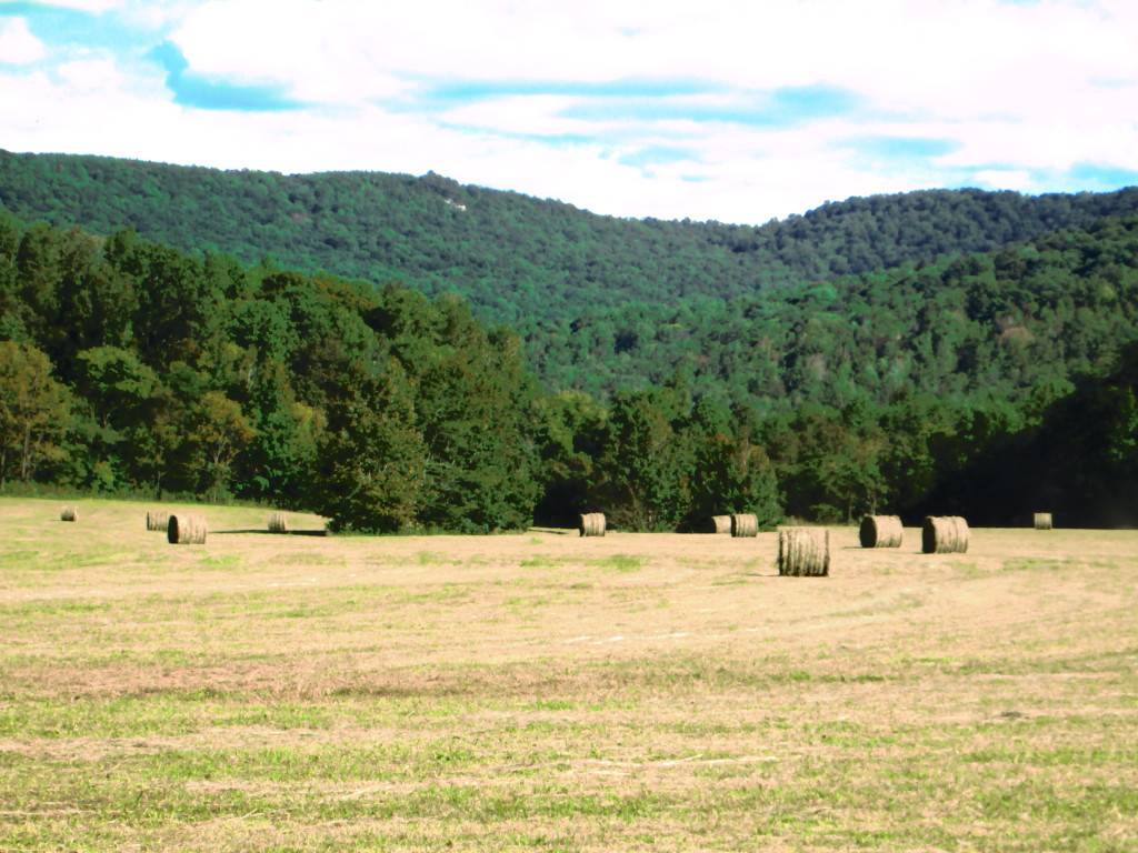
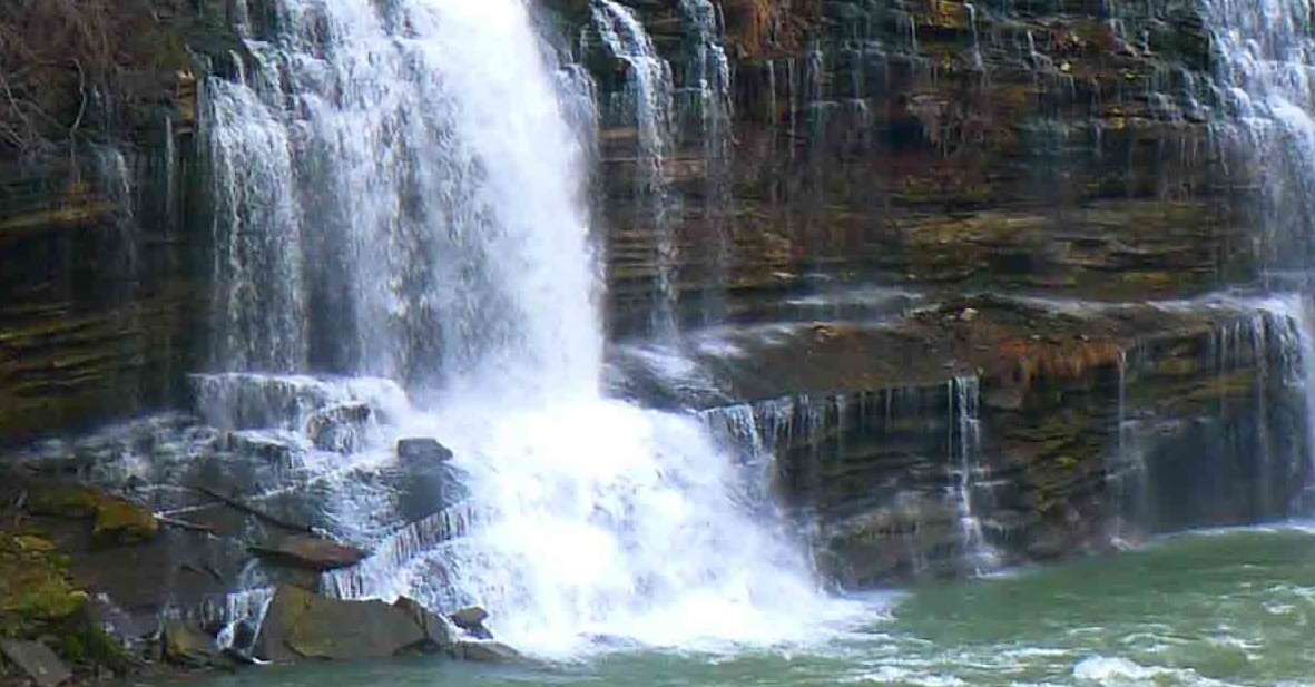
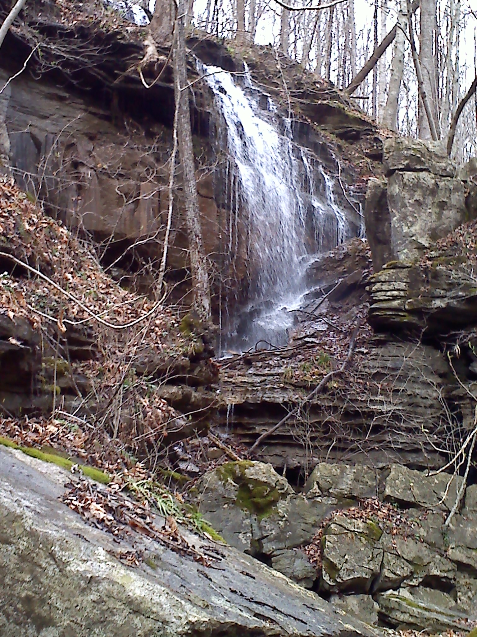
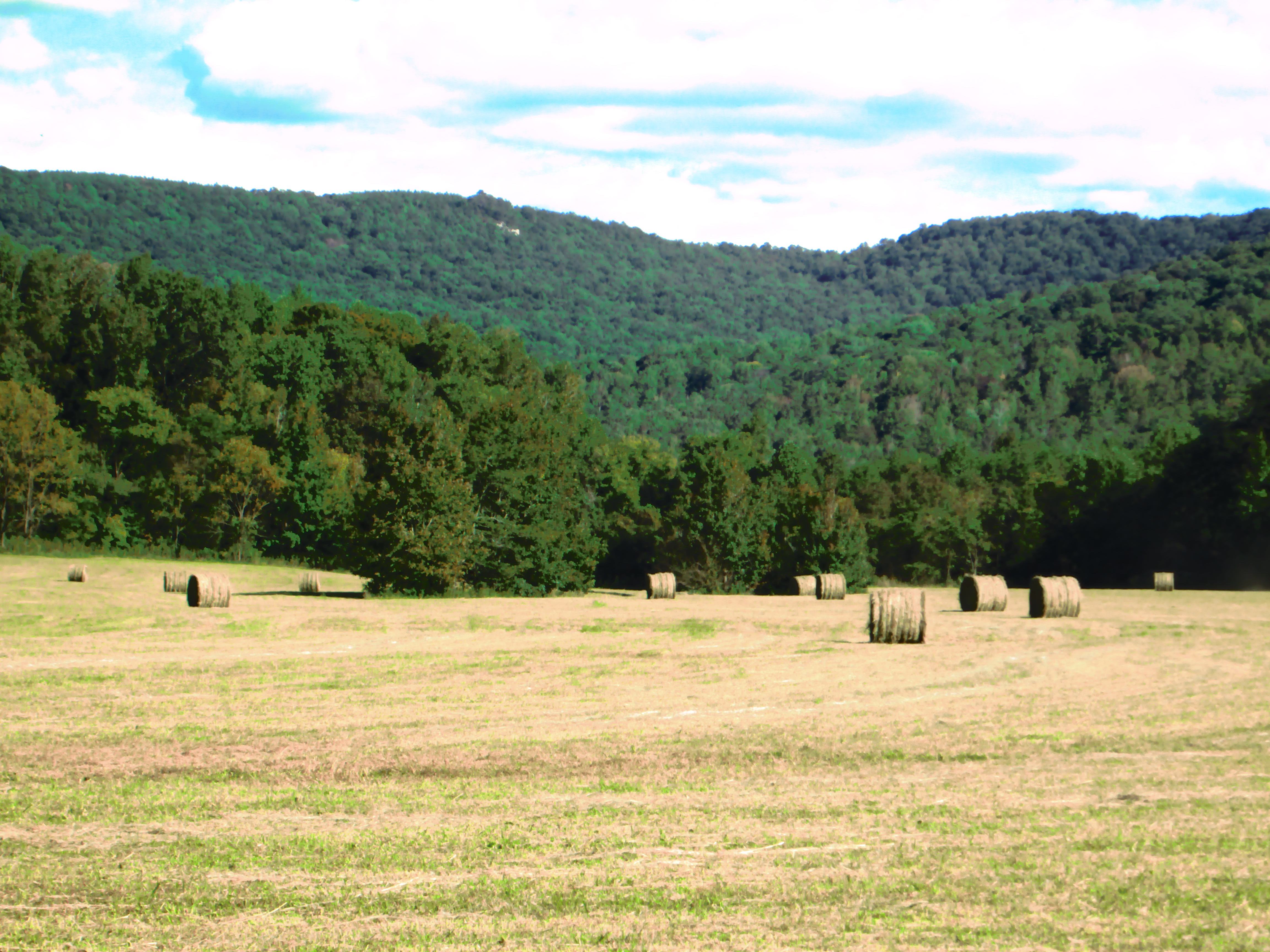
For years, a group of friends would make an annual motorcycle trip from the Cumberlands to Cade’s Cove in the Smokey Mountains. Then one year, one of the riders asked “why do we go to Cade’s Cove when we live here”?  That was an excellent question, there is even an area close by that strongly resembles Cade’s Cove, only this valley has a river that runs through it that is stocked with trout, and you aren’t choking on carbon monoxide from the thousands of cars that are passing through the Smokey Mountains. The local Cade’s Cove is known as Big Bottom; it is formed as the Caney Fork River exits the Cumberland Plateau into the Tennessee Valley.

Big Bottom

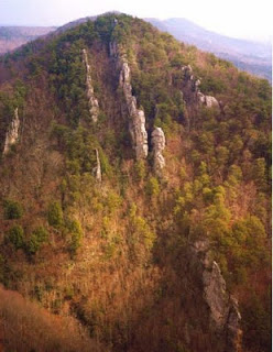
Big Bottom, the outcrop is visible.

For years, I have looked at the mountains behind Big Bottom and asked how to get to a particular rock outcropping that is visible on the south side of the river. Every one who I’ve asked, had no idea. I’ve always enjoyed looking at this valley from the bottom, but I’ve craved seeing it from the top; not to mention, what a wonderful addition that overlook would make to the Mid Cumberland Trail. I knew that peering through the gap that allows the Caney Fork to pass into the flatter lands of the Tennessee Valley would be worth the adventure. So I plotted, and platted, and used google earth, and a compass, and tax maps, and a GPS to make my best guess of how to reach the top of that rock. In the back of my mind, I knew that a view like that would have a well-warn path leading straight to it – – boy was I wrong.

The closest that I could drive, even in my 4×4 truck is in a community called Mooneyham, on a road called Graveyard Ridge Road. I had set the calculated coordinates in my GPS the night before, as I approached, I meandered up and down several logging roads watching the blip on the screen to optimize my hike. The closest point that I could park was 1.25 air-miles away.  I left the truck, dashed into the brush and sometime after the GPS registered six miles, the batteries died; I was on my own.

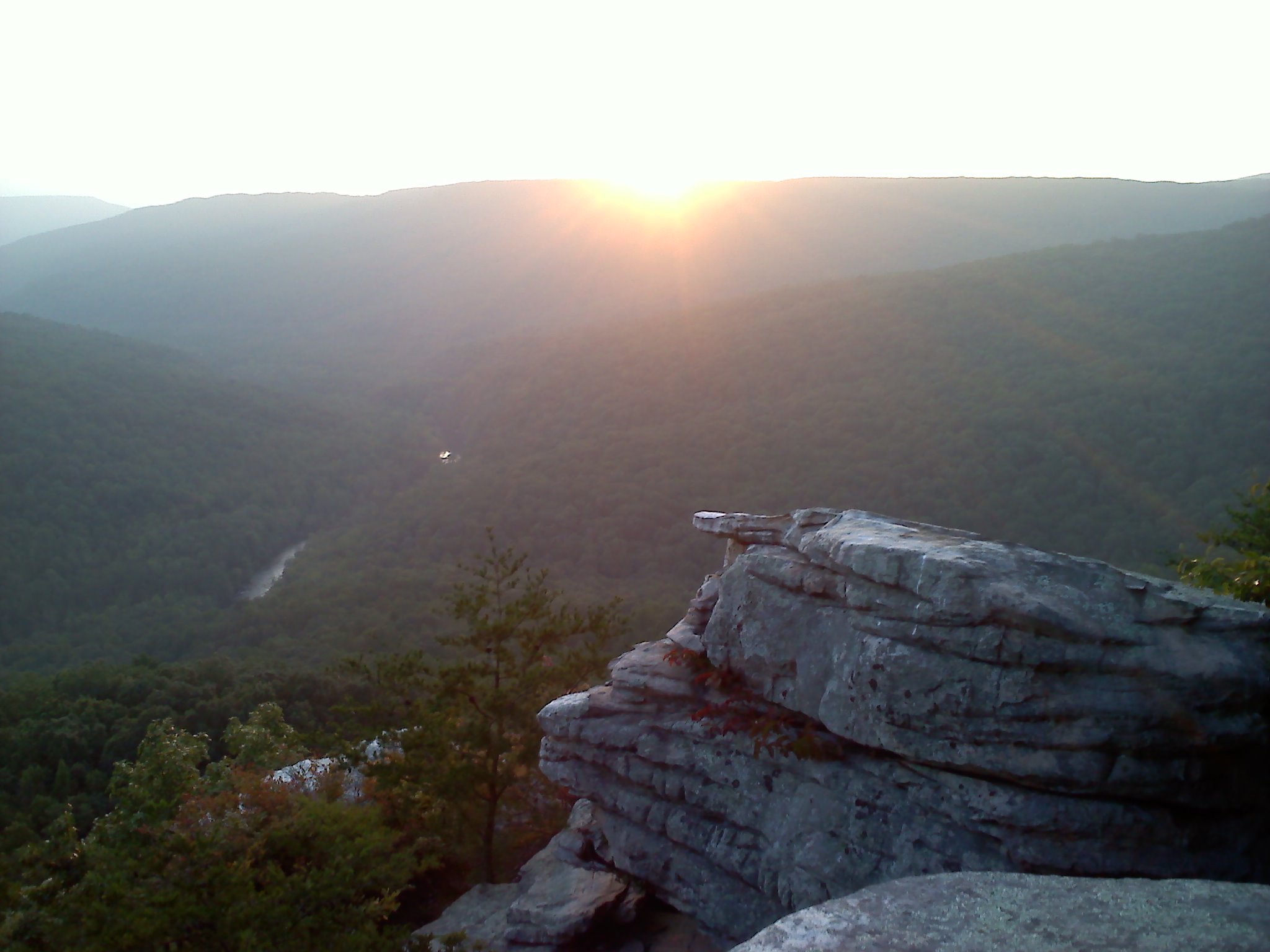
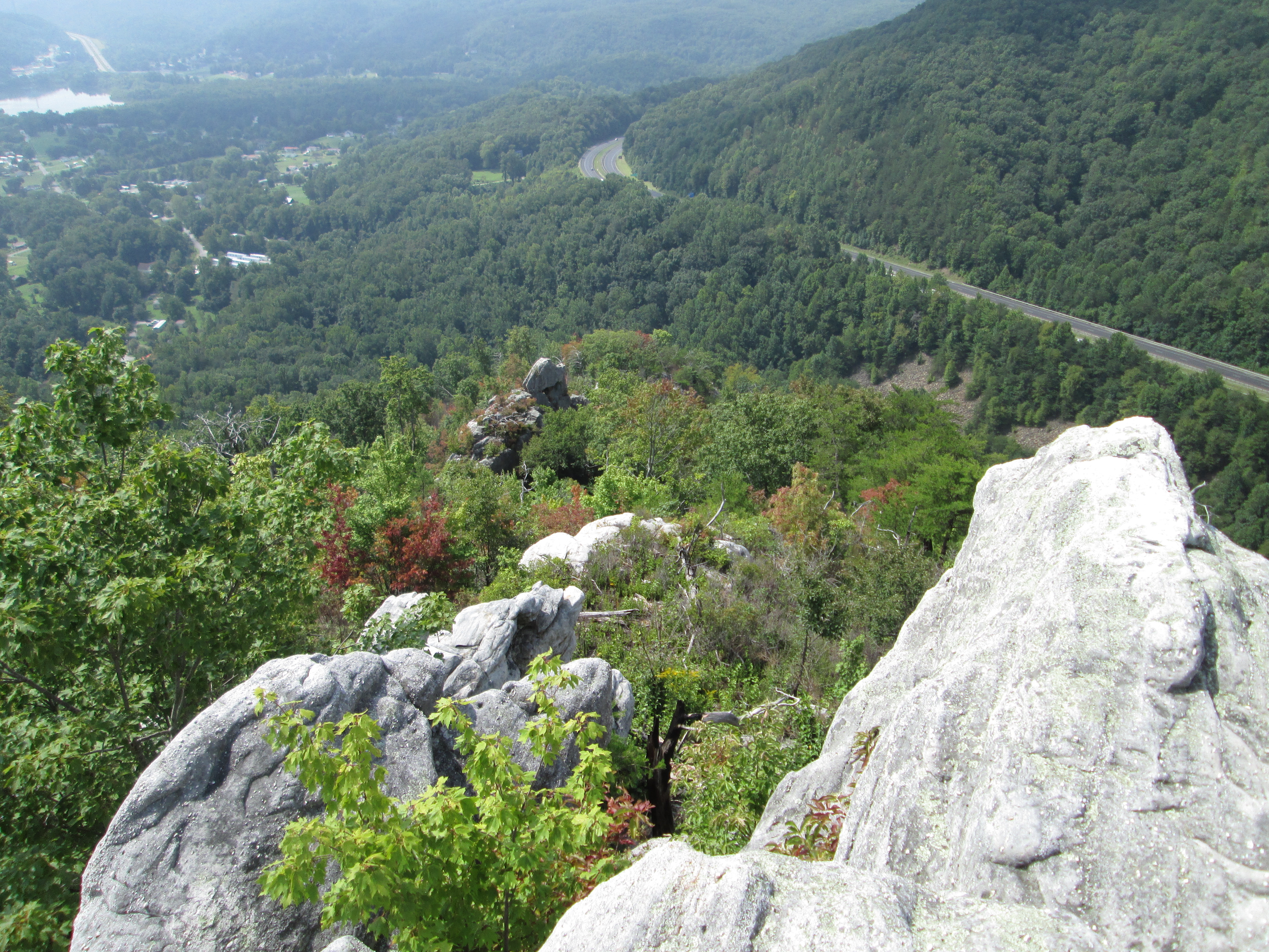
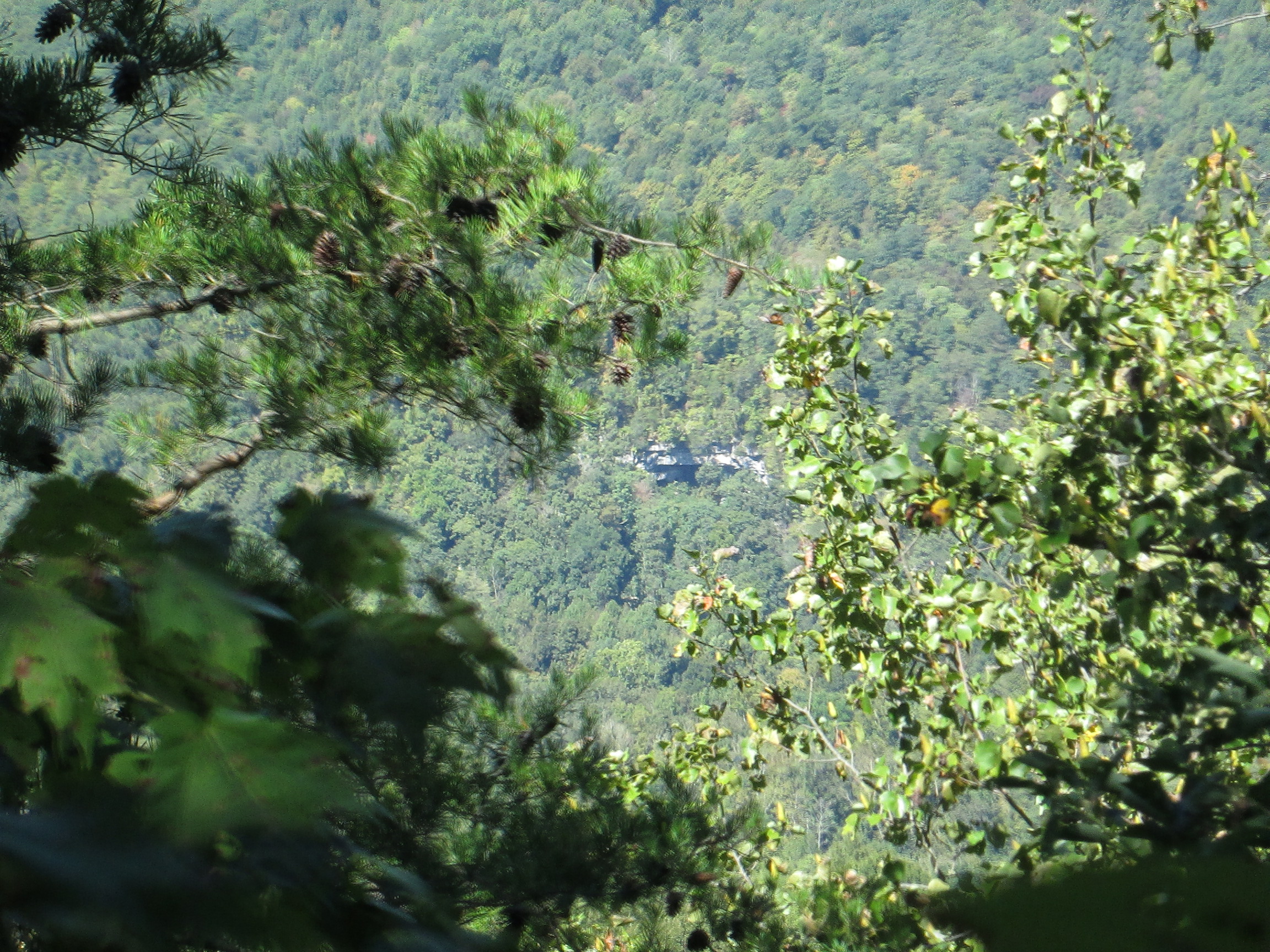
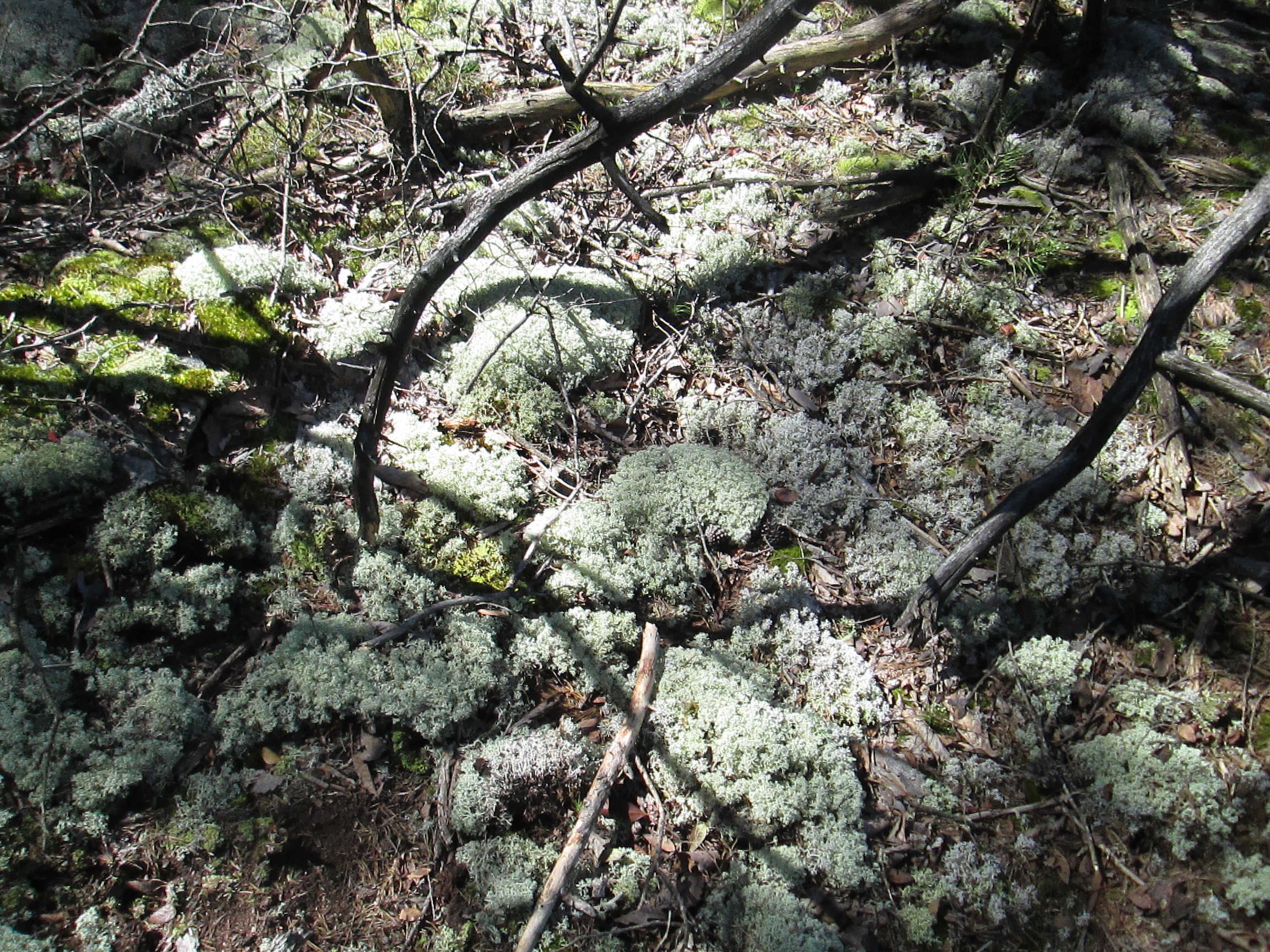
In places, the brush was so thick, I literally could not see twenty-five feet, and I had to pull out my hand-compass to make sure that I wasn’t walking in circles.  When I finally got to the edge of the escarpment, the point where the top of the plateau plunges into the Caney Fork River Gorge, the pine thickets gave way to beautiful hardwoods. And I walked that edge, and I walked that 2014-09-25 12.07.31
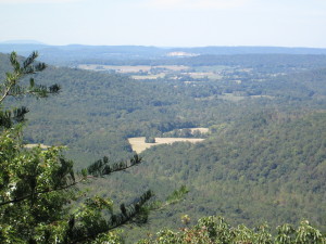
edge, and I walked that edge. A few times, I came across paths, or four-wheeler trails, I was convinced that they would be headed to the overlook; I followed each to their end, and they didn’t. I finally found this vista, but it did not compute; I should see more vertical drop between me and the tree tops. But none the less, I could see Big Bottom below, the rock quarry in Doyle, and if you look in the upper left corner of the photograph, I could see Short Mountain in the distance which would be at least 25 miles away. I doubt that I am the only human being who has ever stood in that spot, but judging from the fragile, inches-thick moss at my feet; I suspect that it had been a long long time since it was disturbed. And as much as I hate to acknowledge it, when I finally got back to my truck, and drove the twenty plus miles around to Big Bottom, I confirmed that the overlook that I was standing at, could not be the rock outcropping that I am searching for. The bluff that I was standing on would be shielded from view from the valley by the trees that rise above the crest. My 6′ stature is the only reason that I could get the above photograph from that point. And to make matters worse, while I was walking that edge, at another point, I could peer through the trees and spotted yet another outcropping, on the far side of the river – – another quest for another day.

2014-09-25 11.56.17

Huge Rock House on the north side of the Caney Fork

2014-09-25 12.02.04

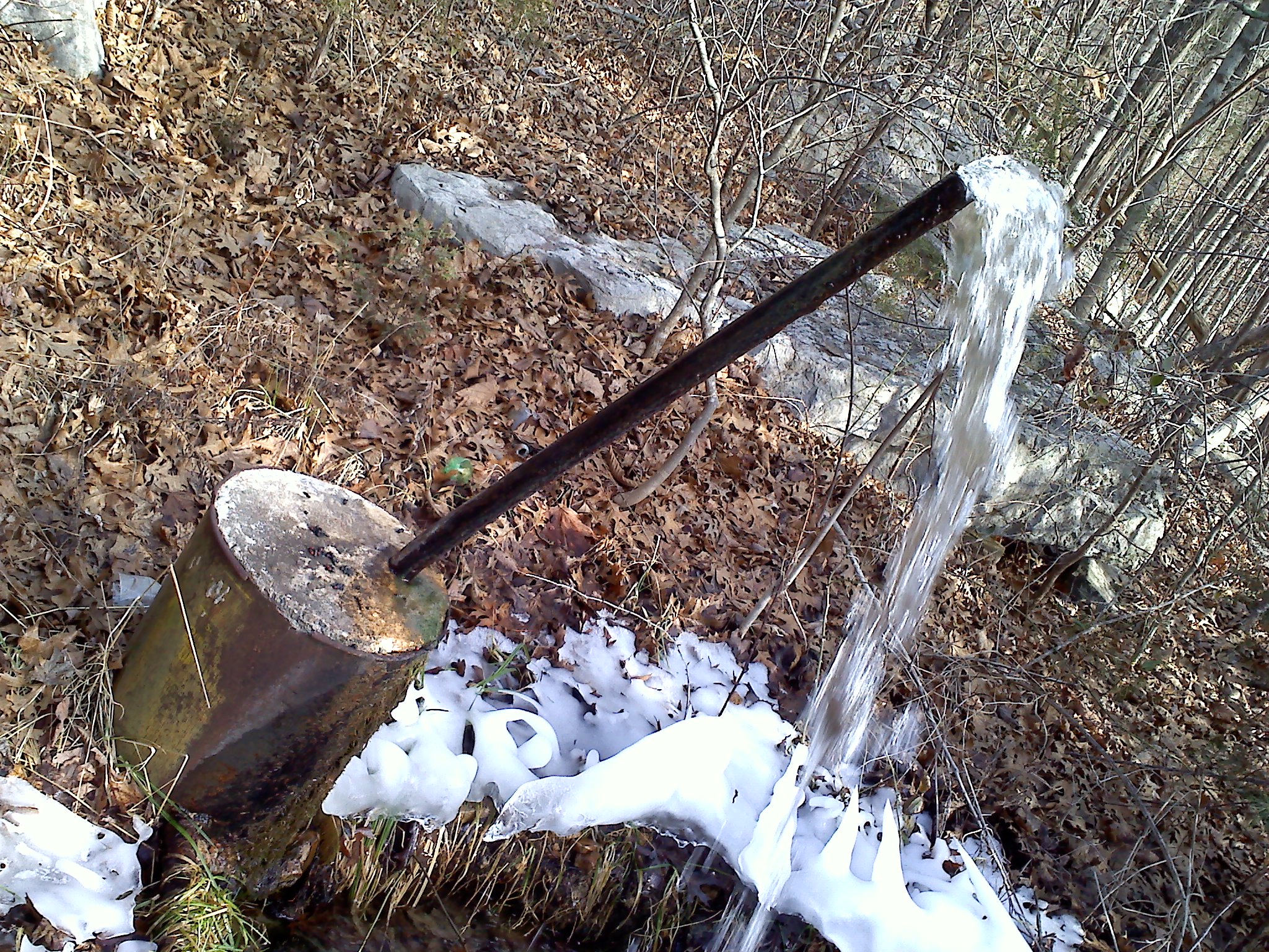
This fragile moss indicated how seldom this vista was visited.

[mashshare]

Crusher Hole

My parents brought me here as a child. I had never seen water this color, or a place more beautiful. It stuck in my mind and as soon as I had a driver’s license I started returning; sometimes to fish, sometimes to swim, and sometimes just to sit and look.

Crusher Hole

Crusher Hole

The generic name for this geologic feature is blue hole denoting an underwater spring. As you can see, the water close by is sort of green, but as you swim across the creek it becomes more blue and clear – – and much more cold.

This blue hole occurs along Cane Creek in Van Buren County. This is the same Cane Creek that flows across Cane Creek Falls in Fall Creek Falls State Park. The stream doubles in volume at this confluence when the warmer greener water flowing along the western shore mingles with the cool dense resurgence from Camp’s Gulf Cave. To visit the Crusher Hole; from Hwy 111, turn east on Hwy 285 and go 6.4 miles. When you get to the bridge over Cane Creek, the property is on the left. You may access it through the field, or cross the bridge and turn left on Owl Hole Road.

Trout love it here – – I do too.

[mashshare]

Hemlock Falls

2014-09-14 18.20.20 The land of falling water, the western edge of the Cumberland Plateau. Four counties, seventy-two waterfalls. This area is home to the highest waterfall in the eastern United States; but vertical drop doesn’t necessarily determine spectacular. Sometimes the beauty of a falls may be the clarity of the water, sometimes it may be the surrounding landscape, sometimes the sound is so unique you can enjoy it with your eyes closed, in this case all of the last three criterion apply. Nestled on the edge of Fall Creek Falls State Park, the discovery of this falls was so recent; it doesn’t yet show up as a Tennessee landform.

The falls marks the end of the Prater Place Trail. Though the sign at the trail head says it’s 2.7 miles; two GPS’ indicate it is 3.67 miles each way with a 500′ elevation change. The trail takes you near one of my favorite caves, Camps Gulf; and the Prater home place – – how did I settler eek out a living here?2014-09-15 19.55.42

As you hike the trail, note that the stream bed may be dry. During rainy weather, it can swell substantially as water will dump out of the cave systems into this creek. But on a typical summer’s day, you may be discouraged – – don’t be. Somewhere, between Cane Creek and the falls the water disappears. Die tracing shows it winds up in Camps Gulf Cave only to flow out a few miles away at the Crusher Hole.

To get to the trail, from Hwy 111, head east on 285 6.4 miles. When you cross the Cane Creek bridge; the trail parking lot will be the second road on the left. It’s worth the drive and the hike.

2014-09-14 16.50.03[mashshare]

Welch’s Point in the Bridgestone Firestone Centennial Wilderness

2014-09-08 18.45.09

Welch’s Point. Note the gap between the main rock and the boulder.

One of the most under-recognized gifts that the state of Tennessee has ever received was in the form of a land gift from Bridgestone Firestone Corporation.  Located near Sparta TN this 11,000 acres represents the largest acquisition of land by the state of Tennessee since the Great Smokey Mountains. The property includes miles of headwaters of the Caney Fork River where the whitewater is so good people come form Asia and Europe to run the Class V. There is an abundance of caves, waterfalls, and scenic overlooks like nowhere else on the Cumberland Plateau. The property totally surrounds two other parcels which have since become state-owned. One is Virgin Falls, the second is known as Welch’s Point.

This adventure took place at Welch’s Point during September’s Harvest Moon.  Anyone familiar with Welch’s Point will appreciate this. There is a gap at Welch’s Point that gets you out to a big boulder which gives optimum eastward viewing. I went out there that evening in hopes of getting pictures of the Harvest Moon rising over Scott’s Gulf. I left my pack (including flashlight) on the main rock, and meandered down through the weeds to climb up on the big boulder. It got darker and darker, still no moon. Finally two friends texted me pictures of the moon from other locations and it became obvious that the moon rise was farther north and obscured by the trees. Thank goodness I had my hiking stick, there was still enough light to make out the light stone sides of the crevasse from the dark ground but that was it. Just in case, I was sweeping my walking stick ahead of me before I stepped. I hit what felt like a limp vine and I heard it. The other end of the crevasse is vertical going 100′ down. The sides going up at the highest point are maybe 15’; the adrenaline was like a shot of youth; for a moment my legs were 20 years younger, and my arms were about five feet longer, and I did what I’ve not done in a long long time. I went vertical. I literally went straight up the rock face, grabbed my flashlight from my pack and returned to the edge zooming in on this angry noise-maker with my camera. 

Rattlesnake at Welch's Point.

Rattlesnake at Welch’s Point.


Two months ago, I had hiked to the same spot to get pictures of Scott’s Gulf under a bright full moon. On my return, I caught a glimpse of what appeared to be a bent stick in the road ahead. When I got closer,  I noted that it was bent the other way. That time it was copperhead, but I could easily see to maneuver around it.

I have probably hiked out to Welch’s point more than I have any other trail. I feel as safe there as I do in my own home. Here is my word of caution. No matter how familiar we are with our surroundings; wildlife is a variable that we often dismiss. In the case of the Bridgestone Firestone Centennial Wilderness, I have heard more reports of encounters with venomous snakes this year than all other years combined. I am sure that is partially because of the growing popularity of the area; I strongly suspect that it is also due to an increase in these reptiles as well. Rattlesnakes have been on the endangered-species list for decades, we might be seeing signs that they have rebounded. When we are in the woods, especially after dark, we are in their home – – be wary – – but isn’t that part of the thrill of being outdoors.

[mashshare]


The Birthing Tree

2014-04-25 18.19.40It was alive and probably over forty-feet tall the day that America was born. By the time the country had divided and Lincoln gave the Gettysburg Address, it was over a century old. What began as a single acorn in a forest became shelter along the Old Kentucky Road, one of oldest roads in Tennessee. It earned the moniker “Birthing Tree”, because its location lent itself as a stopping point along a wagon road, and more than one pioneer woman gave birth under its branches.

Timber companies cleared most of its ancestors and progeny to make way for farmland and the growing community of McMinnville. Trails and roads passed sooooo close, but for whatever reason; this tree was always spared. Today it is over a quarter-millennium old; has a crown of one-hundred-twenty-five feet, and is listed in the Tennessee Historic Tree Register as one of the oldest, if not the oldest, tree in Tennessee.

It is certainly the grandest white oak that I have ever seen. I have been known to travel 200 miles out of the way to see a good tree; this one is only a half-hour away. Pack a lunch, and set your GPS to 1559 Sparta Street, McMinnville TN. Though in human terms, it already has been – – it won’t be there forever.

PS     Right before I put my camera away, a sign on the hospital across the highway caught my              eye. Coincidence? 2014-04-25 18.20.04

[mashshare]

The Devil’s Racetrack

On the far side of the plateau from Cragrock, lies what has been described as the single-most prominent geologic feature along Interstate 75 between Sault Ste Marie, Michigan and Miami Devils RacetrackFlorida. Scientists say that this feature was created when the North American and African continents collided. Current estimates place continental drift at a whopping 8/10 inches per year – – which indicates a very long time ago.

The collision caused the plates to split and in the case of “The Devils Racetrack”, they were turned vertically. Over time, the softer rocks dissolved leaving these giant stone slabs protruding vertically above the surrounding hardwoods. It is absolutely astonishing to see and can be viewed from I-75, just north of Caryville.

The lake at Tennessee’s oldest state park, Cove Lake, was constructed to act as a reflecting pool for this mountain. When viewed from the park, there is a serene beauty. Standing on top lends a whole new meaning to the word panorama.

Cove Lake Was built as a reflecting pool for this mountain.

Looking down, you can see Cove Lake State Park.

The Cumberland Trail runs with I-75 and then along the ridge through the Devil’s Racetrack feature. Round-trip from Cove Lake is a moderate day’s hike and one of my favorites. The intense mix of forest vegetation, wildlife, and gradual slope overcomes the noise from the interstate; nature and infrastructure collide – – but the scenery wins. I’ve stood on top and looked down on clouds, birds, and even aircraft.

This is just one more example of why when you live on the Cumberland Plateau, you don’t have to leave home to take a vacation.

2014-08-23 11.52.44

Straddling one of the stone spines at Devil’s Racetrack.

2014-08-23 10.33.08

The property is recovering nicely from a forest fire only five months ago.

2014-08-23 10.10.16

This beautiful double-drop waterfall is quite unique in that it was man-made when the stream had to be re-routed to build I-75. Note the vertical boring marks on the right cliff face.

[mashshare]


The Bon Air Spring

The Top of Bon Air Mountain, near Sparta TN, was once home2014-08-13 09.29.55 to a wonderful lodge. Only verbal descriptions of that lodge exists today, but apparently it was grand. Porches lined the perimeter of the lodge and it was positioned on the western-most point of the Cumberland Escarpment. Built close to the bluff’s edge, the lodge afforded fantastic views of the Tennessee Valley below. The popularity of the lodge wasn’t solely for the traveler’s of the Old Stage Road, the waters from the Bon Air Spring allegedly had healing properties. People literally came from adjoining states to bathe and drink the cool water from the spring. All that is left of the lodge are a few cornerstones; it fell victim to the Civil War; both sides claiming that it was a haven for spies – – it was burned to the ground and never rebuilt.

The county has created a pull-off to keep people from blocking traffic on the road while retrieving water from the spring.  In 2004, Junior Forsyth and Carmon Hamby poured a concrete pad with culvert and concrete tables to rest the water jugs as they fill. A local reports having had the water tested; he was told that municipalities would be proud to have water that pure coming OUT of their filtration system. Regardless of rain or season, it takes about two minutes to fill a gallon jug.

2014-03-11 08.59.59It is not unusual to find people waiting in line to capture Bon Air water. Perhaps, at one time, one of those people was Shell Roberts Nyleptha Matilda Bryant. When she died, Shell was the 20th oldest person on a planet of seven billion people.  She grew up on Bon Air mountain, worked and played in the farm fields; now she rests about a half-mile from the spring in the Old Bon Air Cemetery.

No one can say for sure that drinking the water at Bon Air resulted in Shell’s longevity; but I will confide, while I’m writing this post, I am sipping on a glass of that water – – just in case.

[mashshare]

The Cragrock Geyser

2014-01-26 14.49.13Along the edge of the Old Stage Road, just a few hundred feet from the Rock House Historic Shrine, near Sparta TN, a pipe erupts through an old metal bucket filled with concrete. Even during the driest of droughts, copious amounts of pure water pour from that pipe. For many years people have claimed that the force in the pipe was artesian. The fact is, farther up the mountain the water is cordoned and funneled through a hodge-podge of pipe miraculously laid through the rocks to a point just above the Rock House. Allegedly this was a refueling point for early trains to take on water for for their steam engines. Later a cistern was erected and the water was used to supply a number of homes in Bear Cove.

Curators at the “Rock House” and many others have drank from the spring. The water is so clear, one might think that a municipal water line had burst. The pipe doesn’t freeze in the winter. The flow doesn’t seem to diminish in the summer. There is no telling how long that spring has flowed and doesn’t seem to tire. The pipe and bucket make a crude fountain, a joy to see and hear.

[mashshare]